Area Overview for Arlesey & Fairfield Ward
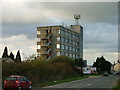
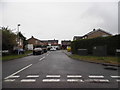
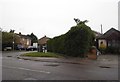
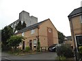
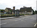
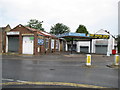
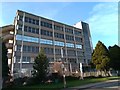
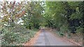
Photos of Arlesey & Fairfield Ward
Area Information
Living in Arlesey & Fairfield Ward defines a life of quiet stability rather than urban dynamism. This district borough unitary ward covers a specific geographic footprint of 11.5 km². Within these boundaries, 1,534 residents navigate daily life alongside a shared sense of locality. The area offers a low-density environment where the pace is generally manageable for those seeking a singular purpose living in Arlesey & Fairfield Ward. You will find the space proportionate to a population under two thousand people, creating an intimate sense of community without the congestion of larger towns. Homes in Arlesey & Fairfield Ward sit within settings defined by a density of 134 people per square kilometre. This figure indicates a spread-out residential layout rather than a high-rise or terraced concentration. The ward provides a distinct character that separates it from more populous urban centres in Bedfordshire. Your day-to-day experience will centre on a neighbourhood where residents value space and a predictable routine. There are no traffic hubs or major industrial zones mentioned in the key metrics, suggesting a focus on residential peace. This profile suits individuals who prioritise a calm environment over immediate access to city amenities. The sheer scale of the ward ensures that you will not feel overwhelmed by crowds.
- Area Type
- District Borough Unitary Ward
- Area Size
- 11.5 km²
- Population
- 1534
- Population Density
- 134 people/km²
Demographics
The community structure within Arlesey & Fairfield Ward reflects a population dominated by older residents. Your neighbours likely fall into a senior demographic, with a median age reaching 70 years. This means the area caters specifically to retirement living or later-life stages, rather than young families or recent graduates. Home ownership stands at 72%, a clear indicator that most households reside in properties they fully own rather than renting. Consequently, the financial dynamics of Arlesey & Fairfield Ward differ significantly from areas where rental markets prevail. This high ownership rate often signals long-term settlement and stability within the local community. Household composition and accommodation type data point to a static population structure, with little influx of transient tenants. The ethnic and religious profiles are recorded as total without specific breakdowns, suggesting a homogenous or traditional community makeup. Deprivation metrics are not explicitly quantified in the available figures, but the high ownership rate often correlates with lower economic instability. Living here means engaging with a community where homeowners have deep roots. The age profile ensures that social activities and amenities cater to mature preferences rather than youthful trends.
Household Size
Accommodation Type
Tenure
Ethnic Group
Religion
Household Composition
Age
Household Deprivation
NS-SEC
Explore more demographic insights in this area
Go to Demographics tabPlanning
Planning Constraints
- Flood RiskPremium
- Ramsar Wetland SitesPremium
- Area of Outstanding Natural BeautyPremium
- Protected Nature ReservePremium
- Protected WoodlandPremium