Area Overview for Alresford & Elmstead Ward
Photos of Alresford & Elmstead Ward

Area Information
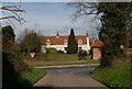
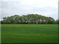
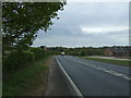
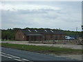
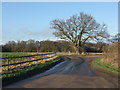
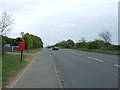
Alresford & Elmstead Ward sits within Tendring District in north-east Essex, bordering the City of Colchester to the west. This district borough unitary ward spans 42.3 km² and currently holds an estimated population of 4018 according to the provided data, though research notes a 2024 estimate near 8,093. Living in Alresford & Elmstead Ward involves navigating the parishes of Alresford and Elmstead with coordinates roughly at 51.87°N, 1.01°E. The area represents a specific slice of the East of England region with a defined administrative identity. You find a community where daily life unfolds against the backdrop of specific place names and local geography. The ward functions as a distinct residential unit within the broader local government structure of Tendring. There are no vague generalisations here; the geography is clear and the boundaries are well defined for those looking at homes in Alresford & Elmstead Ward. Your future address will fall within these specific administrative limits, blending rural parish life with the wider regional context of the county.
- Area Type
- District Borough Unitary Ward
- Area Size
- 42.3 km²
- Population
- 4018
- Population Density
- 1775 people/km²
Demographics
The community profile in Alresford & Elmstead Ward is dominated by an elderly population, with a median age of 70 years. This figure indicates a retirement-oriented demographic rather than a family-centric settlement. Home ownership stands at a striking 84 per cent, suggesting a community where residents are overwhelmingly owners rather than tenants. Accommodation types and household composition data are not explicitly broken down in the provided statistics, but the high ownership rate implies stability and long-term residency. You will find a neighbourhood where people live in conditions that suit retirees or established families looking to settle. The demographic data paints a picture of a settled community where residents have likely remained in their properties for significant periods. There is no data provided on ethnic diversity metrics or religious breakdowns in the immediate source material, so the community picture relies heavily on age and tenure facts. Your potential neighbours are most likely to be over the age of retirement, creating a quiet, established atmosphere as you consider moving to Alresford & Elmstead Ward.
Household Size
Accommodation Type
Tenure
Ethnic Group
Religion
Household Composition
Age
Household Deprivation
NS-SEC
Explore more demographic insights in this area
Go to Demographics tabPlanning
Planning Constraints
- Flood RiskPremium
- Ramsar Wetland SitesPremium
- Area of Outstanding Natural BeautyPremium
- Protected Nature ReservePremium
- Protected WoodlandPremium
- Crime RiskPremium