Area Overview for Almond Hill Ward
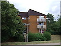
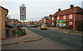
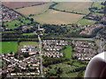
Photos of Almond Hill Ward
Area Information
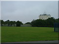
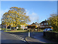
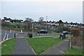
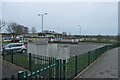
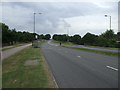
Almond Hill Ward sits within Stevenage Borough Council in Hertfordshire, covering a compact area of 1.5 km². The ward operates as part of the broader Stevenage area in the Eastern English Region, defined by precise coordinates of 51.91°N and 0.19°W. This district council ward emerged following electoral boundary reforms, adopting its current name after serving as the former Pin Green ward. It forms part of Stevenage's thirteen-ward structure and elects three councillors to represent the local community. Living in Almond Hill Ward means residing in a defined administrative district with established governance. The ward's size and location place it firmly within the Stevenage borough boundaries, offering a specific slice of local government service delivery. Residents navigate a neighbourhood shaped by recent boundary adjustments made by the Local Government Boundary Commission for England. The area represents a functional ward within the larger municipal framework, providing clear administrative lines for those signing up for council services or tracking local political representation. The ward's identity is tied to its history as Pin Green before the rebranding process finalised current electoral arrangements. This continuity of place, despite the name change, suggests a settled community bound by long-standing boundaries. Prospective buyers should note that Almond Hill Ward exists as a distinct entity within the Stevenage ward structure, offering a specific postcode location for property searches. The area serves as a recognised neighbourhood unit where residents engage with local governance through their specific three-councillor representation.
- Area Type
- District Borough Unitary Ward
- Area Size
- 1.5 km²
- Population
- Not available
- Population Density
- Not available
Demographics
The community in Almond Hill Ward reflects an older population profile with a median age of 70 years. This high median age suggests a neighbourhood likely dominated by retired residents or those with established long-term ties to the area. Household composition data is recorded but does not specify distinct family structures beyond the total count, indicating a stable residential setting. The demographic picture aligns with a community where younger families may be less prevalent than in other parts of Stevenage. Home ownership stands at 47 per cent within the ward, marking a rental-dominated landscape in terms of tenure. This lower ownership level compared to the national average often points to areas where Properties are primarily let or where older age groups have moved into larger, possibly shared rental accommodations. Accommodation types are logged in the total dataset but lack breakdowns of property styles like semi-detached or terraced homes. Without specific heritage building data, the physical housing stock remains an inference rather than a stated fact. Ethnic diversity and religious affiliation data appear only as total categories without specific percentages. This omission means the precise make-up of the ward's cultural identity remains undisclosed. The absence of detailed religion or ethnicity statistics prevents a full picture of community diversity. Residents should expect a demographic environment centered around older age groups with moderate private ownership levels. The population density and age skew create a specific social dynamic unique to this part of Stevenage.
Household Size
Accommodation Type
Tenure
Ethnic Group
Religion
Household Composition
Age
Household Deprivation
NS-SEC
Explore more demographic insights in this area
Go to Demographics tabPlanning
Planning Constraints
- Flood RiskPremium
- Ramsar Wetland SitesPremium
- Area of Outstanding Natural BeautyPremium
- Protected Nature ReservePremium
- Protected WoodlandPremium