Area Overview for Aldenham West Ward
Photos of Aldenham West Ward
Area Information
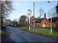
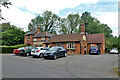
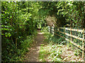
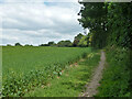
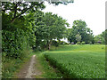
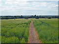
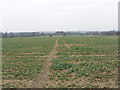
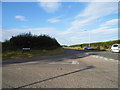
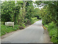
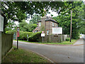
Living in Aldenham West Ward offers a specific lifestyle centred on history and geography within Hertsmere borough. This electoral ward covers 16.9 km² of the western part of the Aldenham civil parish. You will find areas around the village positioned about 3.5 miles north-east of Watford and 2 miles south-west of Radlett. The location lies close to coordinates 51.6723°N 0.3546°W, putting it near the main query point of 51.6729°N -0.3388°W. The area includes hamlets like Letchmore Heath, contributing to a spread-out residential environment. Historically, the parish straddled the boundary of Danish Hundred and St Albans Hundred, a status noted in the Domesday Book of 1086. A small western tip separated in April 2023 to become Hertsmere Meriden parish due to isolation by the M1 motorway. Today, Aldenham remains one of Hertsmere's 14 conservation areas. Eight pre-19th century listed buildings survive, preserving the architectural character of the landscape. You will encounter notable features such as the hamlet of Round Bush, marked by a pub where three roads meet. This ward represents a blend of Saxon origins and modern administrative boundaries, suitable for those seeking a rooted community experience without the density of a major town centre. The history of property disputes over forested land adds a layer of depth to the local identity that residents continue to inhabit.
- Area Type
- District Borough Unitary Ward
- Area Size
- 16.9 km²
- Population
- Not available
- Population Density
- Not available
Demographics
The community in Aldenham West Ward is defined by advanced age and high rates of home ownership. The median age for residents is 70 years old. This figure indicates a heavily senior population compared to national averages. Most households consist of people in the "Age: Total" range, suggesting a broad demographic spread within that senior bracket rather than youth or families with young children. Seven in ten homes are owner-occupied, with a total home ownership rate of 77%. This high percentage reflects a settled market where residents have purchased their properties rather than renting. The predominant ethnic group and religious composition are recorded as total, meaning the ward maintains a standard demographic mix typical of Hertfordshire without specific minority concentrations noted in this dataset. Household composition data confirms a total population structure that aligns with the high median age. Living here means interacting with a mature community where property investment history is long-standing. The 77% ownership figure suggests stability and less transient movement than areas with lower tenure rates. For anyone moving to Aldenham West Ward, the demographic profile points to a quiet, established neighbourhood where residents likely value privacy and consistency over vibrant nightlife or extensive family facilities. The age profile directly influences local spending habits and community engagement styles.
Household Size
Accommodation Type
Tenure
Ethnic Group
Religion
Household Composition
Age
Household Deprivation
NS-SEC
Explore more demographic insights in this area
Go to Demographics tabPlanning
Planning Constraints
- Flood RiskPremium
- Ramsar Wetland SitesPremium
- Area of Outstanding Natural BeautyPremium
- Protected Nature ReservePremium
- Protected WoodlandPremium
- Crime RiskPremium