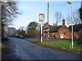
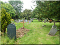
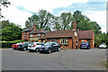
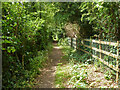
Area Overview for Aldenham
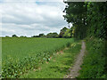
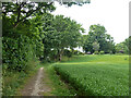
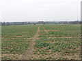
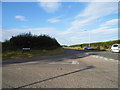
Photos of Aldenham


Area Information
Aldenham is a compact built-up area in England, covering 40.1 hectares. Its demographic profile is shaped by a median age of 70, suggesting a community skewed towards older residents. This is reflected in the local landscape, where practicality and accessibility take precedence. The area’s proximity to key transport hubs, including Radlett Railway Station and Watford Underground Station, makes it a viable option for commuters. For families, Aldenham offers access to two independent schools—Edge Grove School and Hart House School—though the area’s character leans more towards established residents than growing families. Daily life here is defined by a balance of convenience and quietude, with retail options like Costco Watford and Co-op Garston within reach. While the broadband score of 55 indicates moderate connectivity, mobile coverage is strong at 85. This blend of infrastructure and demographics makes Aldenham a pragmatic choice for those prioritising ease of access over dynamic urban amenities.
- Area Type
- Built Up Area 250
- Area Size
- 40.1 hectares
- Population
- Not available
- Population Density
- Not available
Aldenham’s lifestyle is defined by its proximity to retail and transport hubs. Within practical reach are major stores like Costco Watford, Co-op Garston, and Budgens Radlett, offering a range of shopping options. The area’s railway and metro stations provide seamless access to London and nearby towns, making it a commuter-friendly location. While parks or leisure facilities are not specified in the data, the presence of multiple transport links and retail venues suggests a focus on practicality over leisure. For residents, this means daily life revolves around accessibility, with amenities designed to meet immediate needs rather than foster extended social or recreational activities.
Amenities
Schools
Aldenham’s educational landscape includes two independent schools: Edge Grove School and Hart House School. Both are private institutions, offering alternative options for families seeking non-state education. The absence of state school data means the area’s public schooling options are not detailed, but the presence of independent schools suggests a community where private education is accessible. For families prioritising school choice, these institutions provide structured alternatives. However, the lack of Ofsted ratings or performance metrics means potential buyers must rely on other factors, such as proximity to transport or local amenities, when evaluating the area’s suitability for education.
| Rank | School | Type | Entry gender | Ages |
|---|
Explore more schools in this area
Go to Schools tabDemographics
Aldenham’s population is predominantly older, with a median age of 70. This suggests a community where retirees or long-term residents form the majority. Home ownership is high at 71%, indicating a stable, owner-occupied market. The data does not specify household composition or accommodation types, but the overall profile points to a settled, less transient population. The absence of detailed figures on diversity or religious affiliation means the area’s cultural makeup remains opaque. However, the high home ownership rate implies a focus on long-term residency rather than rental turnover. For prospective buyers, this suggests a market where properties are likely to remain in the same hands for extended periods. The area’s practical amenities and transport links cater to a demographic that values reliability over novelty.
Household Size
Accommodation Type
Tenure
Ethnic Group
Religion
Household Composition
Age
Household Deprivation
NS-SEC
Explore more demographic insights in this area
Go to Demographics tabPlanning
Planning Constraints
- Crime RiskPremium