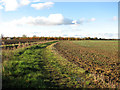
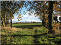
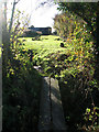
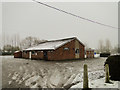
Area Overview for Alburgh Street
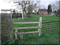
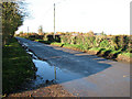
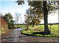
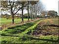
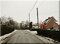
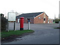
Photos of Alburgh Street


Area Information
Living in Alburgh Street offers a quiet, compact community within a 32.8-hectare built-up area. The area’s character is defined by its mature population, with a median age of 70, suggesting a settled, long-term resident base. Home ownership is high, at 77%, indicating a stable housing market. Daily life here is likely shaped by proximity to local amenities, including five retail outlets such as Morrisons Daily and Budgens Harleston, which provide essential shopping. The presence of two primary schools, Alburgh with Denton Church of England Primary School and Alburgh With Denton Church of England Primary Academy, underscores the area’s appeal to families. While the broadband score is low (15), mobile coverage is good (79), balancing practical needs for connectivity. Alburgh Street’s compact size means residents can access nearby services without long commutes, though the area’s distinctiveness lies in its blend of traditional living and functional infrastructure.
- Area Type
- Built Up Area 250
- Area Size
- 32.8 hectares
- Population
- Not available
- Population Density
- Not available
Residents of Alburgh Street have access to five retail outlets within practical reach, including East of England Co-operative Co, Budgens Harleston, and Morrisons Daily. These shops provide everyday essentials, contributing to a convenient lifestyle. The area’s small size ensures amenities are close, though details on parks, leisure facilities, or dining options are not included in the data. The presence of multiple retail venues suggests a focus on practicality, with local shopping likely meeting most needs. While the data does not specify other amenities, the proximity to schools and shops implies a community-oriented environment where daily errands are manageable without lengthy trips.
Amenities
Schools
Residents of Alburgh Street have access to two primary schools: Alburgh with Denton Church of England Primary School and Alburgh With Denton Church of England Primary Academy. Both are primary institutions, though specific Ofsted ratings are not provided in the data. The presence of two schools may indicate a focus on early education, with potential for smaller class sizes or shared resources. Families seeking primary education may benefit from the proximity of these institutions, though the absence of secondary schools or higher education facilities is not addressed here. The schools’ names suggest a connection to local religious or community organisations, which could influence their ethos or extracurricular offerings.
| Rank | A + A* % | School | Type | Entry gender | Ages |
|---|---|---|---|---|---|
| 1 | N/A | Alburgh with Denton Church of England Primary School | primary | N/A | N/A |
| 2 | N/A | Alburgh With Denton Church of England Primary Academy | primary | N/A | N/A |
Explore more schools in this area
Go to Schools tabDemographics
Alburgh Street has a median age of 70, reflecting a predominantly older population. The home ownership rate of 77% suggests a community where most residents live in their own homes, contributing to a sense of stability. Household composition and accommodation types are reported as totals, but the high ownership rate implies a mix of family homes and single-occupancy properties. The area’s demographic profile is not explicitly detailed in terms of ethnic or religious diversity, but the data indicates no specific groups dominate. This age profile may influence local services, with healthcare and community centres likely catering to older residents. The absence of specific deprivation metrics means quality of life is inferred from the area’s safety and amenities.
Household Size
Accommodation Type
Tenure
Ethnic Group
Religion
Household Composition
Age
Household Deprivation
NS-SEC
Explore more demographic insights in this area
Go to Demographics tabPlanning
Planning Constraints
- Crime RiskLocked