Area Overview for AL9 7NH
Photos of AL9 7NH
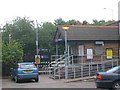
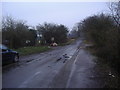
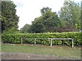
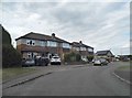
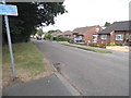
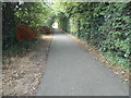
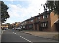
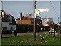

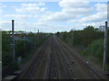

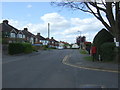
33 photos from this area
Area Information
Key information about the AL9 7NH including its size, population, and administrative classification.
- Area Type
- Postcode
- Area Size
- 5029 m²
- Population
- 2361
- Population Density
- 1502 people/km²
House Prices in AL9 7NH
31
Properties
£127,746
Average Sold Price
£30,000
Lowest Price
£400,000
Highest Price
Showing 31 properties
| Address | Type | Beds | Baths | Last Sale Price | Last Sale Date | |
|---|---|---|---|---|---|---|
| 41 Vincenzo Close, Welham Green, Hatfield, AL9 7NH | Flat | - | - | £175,000 | Jan 2022 | |
| 79 Vincenzo Close, Welham Green, Hatfield, AL9 7NH | Semi-detached | 2 | 1 | £400,000 | Jan 2022 | |
| 75 Vincenzo Close, Welham Green, Hatfield, AL9 7NH | Semi-detached | 2 | 1 | £305,000 | Sep 2015 | |
| 85 Vincenzo Close, Welham Green, Hatfield, AL9 7NH | house | 2 | 1 | £262,000 | Jun 2014 | |
| 77 Vincenzo Close, Welham Green, Hatfield, AL9 7NH | Semi-detached | 2 | 1 | £238,000 | Jun 2013 | |
| 43 Vincenzo Close, Welham Green, Hatfield, AL9 7NH | Flat | - | - | £88,000 | Dec 2012 | |
| 91 Vincenzo Close, Welham Green, Hatfield, AL9 7NH | house | 2 | 1 | £230,000 | Apr 2011 | |
| 73 Vincenzo Close, Welham Green, Hatfield, AL9 7NH | Flat | - | 1 | £97,000 | Mar 2011 | |
| 49 Vincenzo Close, Welham Green, Hatfield, AL9 7NH | Flat | - | - | £98,500 | Jul 2010 | |
| 67 Vincenzo Close, Welham Green, Hatfield, AL9 7NH | Flat | 1 | 1 | £109,000 | Apr 2010 |
Page 1 of 4
Energy Efficiency in AL9 7NH
Amenities
Schools
| Rank | School | Type | Entry gender | Ages |
|---|
Explore more schools in this area
Go to Schools tabDemographics
Household Size
Family (3-5 people)
most common
Accommodation Type
Houses
most common
Tenure
59
majority
Ethnic Group
White
most common
Religion
N/A
most common
Household Composition
N/A
most common
Age
47
median
Adults (30-64 years)
most common
Household Deprivation
N/A
with no deprivation
NS-SEC
31
in Lower managerial occupations
Explore more demographic insights in this area
Go to Demographics tabPlanning
Planning Constraints
- Flood RiskPremium
- Ramsar Wetland SitesPremium
- Area of Outstanding Natural BeautyPremium
- Protected Nature ReservePremium
- Protected WoodlandPremium