Area Overview for AL9 7AW
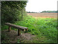
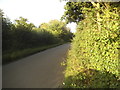
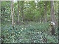
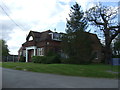
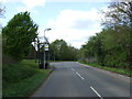
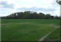
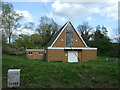
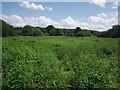
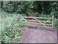
Photos of AL9 7AW
Area Information
Living in AL9 7AW means being part of a small, tightly knit residential cluster in Hertfordshire, just north of London. With a population of 1,611 spread across 170 people per square kilometre, this area offers a quiet, low-density lifestyle. The postcode covers parts of North Mymms, a historic parish with roots in the 13th century, featuring hamlets like Welham Green and Bell Bar. The landscape includes ancient manor estates such as North Mymms Park, an Elizabethan mansion with a rich history of ownership by figures like the Coningsby family. Residents benefit from proximity to rail networks, with stations like Brookmans Park and Potters Bar providing easy access to London. Daily life here balances rural tranquillity with commuter convenience, supported by nearby retail hubs like Tesco Potters and Co-op Brookmans. The area’s blend of heritage and practicality makes it appealing for those seeking a slower pace without sacrificing connectivity.
- Area Type
- Postcode
- Area Size
- Not available
- Population
- 1611
- Population Density
- 170 people/km²
AL9 7AW is primarily an owner-occupied area, with 81% of homes owned by residents rather than rented. The accommodation type is predominantly houses, which is typical of smaller, rural postcode clusters. This suggests a market focused on family homes and long-term residency rather than short-term rental properties. The limited size of the area means housing stock is constrained, so buyers may need to consider nearby postcode districts for more options. The high home ownership rate indicates a stable market with potential for capital growth, though property availability is likely limited. For those seeking a home in this area, the emphasis on houses means buyers should prioritise properties that meet their family needs, while also considering proximity to transport links for commuting.
House Prices in AL9 7AW
No properties found in this postcode.
Energy Efficiency in AL9 7AW
Residents of AL9 7AW enjoy access to nearby amenities such as Co-op Brookmans, Tesco Potters, and Tesco Hatfield, offering essential shopping and dining options. The area’s historical character is evident in landmarks like North Mymms Park, an Elizabethan mansion with a ha-ha and Church Park pond, and St. Mary’s Church, a Decorated Gothic building with historical monuments. These sites provide cultural and recreational value. The proximity to rail stations ensures easy access to urban centres, while the rural setting offers green spaces for leisure. The combination of heritage, retail, and transport links creates a lifestyle that balances tradition with modern convenience, appealing to those who value both history and practicality in their daily lives.
Amenities
Schools
| Rank | School | Type | Entry gender | Ages |
|---|
Explore more schools in this area
Go to Schools tabDemographics
AL9 7AW has a median age of 47, with the majority of residents aged between 30 and 64. This suggests a community skewed towards middle-aged adults, likely including families and professionals. Home ownership is high at 81%, indicating a stable, long-term resident base. The area is predominantly occupied by houses, reflecting a focus on family homes rather than flats or apartments. The predominant ethnic group is White, though no specific diversity metrics are provided. With a population density of 170 people per square kilometre, the area avoids overcrowding, offering a balance between suburban spread and community cohesion. The age profile suggests a mature demographic, potentially influencing local services and amenities. This profile aligns with the area’s historical character and its appeal to those seeking established, low-maintenance living.
Household Size
Accommodation Type
Tenure
Ethnic Group
Religion
Household Composition
Age
Household Deprivation
NS-SEC
Explore more demographic insights in this area
Go to Demographics tabPlanning
Planning Constraints
- Flood RiskPremium
- Ramsar Wetland SitesPremium
- Area of Outstanding Natural BeautyPremium
- Protected Nature ReservePremium
- Protected WoodlandPremium