Area Overview for AL9 6LE
Photos of AL9 6LE

Area Information
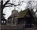
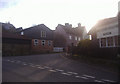
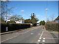
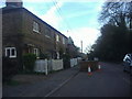
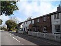
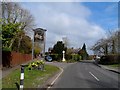
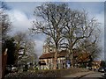
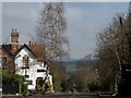
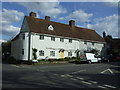
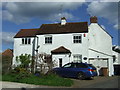
Living in AL9 6LE, a small residential cluster in Hertfordshire, offers a blend of quiet village life and accessible connectivity. The area, centred on the village of Essendon, sits 10 kilometres south-west of Hertford and is defined by its low population density of 91 people per square kilometre. With 1,747 residents, the community feels close-knit, with a median age of 47 and a strong presence of adults aged 30–64. The village’s historical roots are evident in landmarks like St Mary’s parish church, which dates to the 15th century and survived a wartime airship attack in 1916. Daily life here is shaped by proximity to the Lea Valley, rural vistas, and nearby amenities such as Hatfield Railway Station. While the area is small, its strategic location on the B158 road and rail links to Hertford and London make it appealing for commuters. The mix of historic architecture and modern convenience, from local shops to broadband connectivity rated 72/100, creates a balanced lifestyle for those seeking stability without urban sprawl.
- Area Type
- Postcode
- Area Size
- Not available
- Population
- 1747
- Population Density
- 91 people/km²
AL9 6LE is primarily an owner-occupied area, with 63% of homes owned by residents rather than rented. The accommodation type is predominantly houses, which aligns with the village’s character and the presence of historic properties like Camfield Place and Holwell Court. This suggests a market skewed towards family homes and long-term residents rather than short-term rentals or high-density housing. Given the small size of the postcode area, the housing stock is limited, meaning buyers may need to consider nearby villages or towns for more options. The focus on houses also implies potential for larger properties with garden space, appealing to those prioritising privacy and space over urban convenience.
House Prices in AL9 6LE
No properties found in this postcode.
Energy Efficiency in AL9 6LE
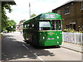
AL9 6LE’s lifestyle is shaped by its proximity to retail outlets such as Morrisons Daily Welwyn, Co-op Ludwick, and Budgens Hatfield, ensuring daily essentials are within reach. The village itself offers historical and cultural landmarks like St Mary’s parish church and the Rose and Crown pub, adding character to local life. Nearby rail stations provide access to broader amenities, while the surrounding countryside offers recreational opportunities. The mix of historic sites, local shops, and transport links creates a balanced lifestyle, blending rural tranquillity with practical convenience for residents.
Amenities
Schools
The nearest school to AL9 6LE is Essendon CofE (VC) Primary School, which provides education for younger children and holds a good Ofsted rating. This school is the only one explicitly listed in the data, meaning families with older children would need to look further afield for secondary education. The presence of a primary school with a positive rating is a key consideration for families prioritising local schooling, though the absence of secondary schools nearby may influence decisions about proximity to larger towns like Hertford or St Albans.
| Rank | School | Type | Entry gender | Ages |
|---|
Explore more schools in this area
Go to Schools tabDemographics
The community in AL9 6LE is predominantly composed of adults aged 30–64, with a median age of 47. Homeownership is strong, at 63%, reflecting a settled population. The area is characterised by houses rather than flats, suggesting a focus on family-friendly living. The predominant ethnic group is White, though specific data on diversity or deprivation is not provided. The low population density of 91 people per square kilometre indicates a spread-out, less congested environment. For quality of life, the age profile suggests a mature community with established residents, though the absence of data on younger demographics or social deprivation means the full picture of daily life remains partially unexplored.
Household Size
Accommodation Type
Tenure
Ethnic Group
Religion
Household Composition
Age
Household Deprivation
NS-SEC
Explore more demographic insights in this area
Go to Demographics tabPlanning
Planning Constraints
- Flood RiskPremium
- Ramsar Wetland SitesPremium
- Area of Outstanding Natural BeautyPremium
- Protected Nature ReservePremium
- Protected WoodlandPremium