Area Overview for AL9 6BB
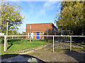
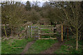
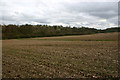
Photos of AL9 6BB
Area Information
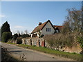
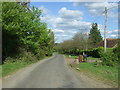
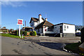
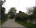
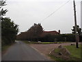
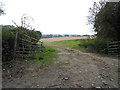
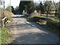
Living in AL9 6BB, the postcode area covering Essendon village in Hertfordshire, offers a quiet, historic rural setting with a small, close-knit community. The village lies 10 kilometres south-west of Hertford, situated on the B158 road at an elevation of 100 metres, offering views of the Lea Valley. With a population of 1,747 and a density of 91 people per square kilometre, Essendon balances rural charm with practical amenities. The area’s character is defined by its 17th- and 18th-century architecture, including St Mary’s parish church, which dates back to the 15th century and features a Wedgwood ceramic font. The village’s history includes wartime events, such as the 1916 bombing by a German airship, and notable residents like Barbara Cartland. Residents benefit from nearby rail connections and a mix of local shops, though the area remains largely residential, with homes outnumbering commercial spaces. Its compact size means daily life revolves around village centres, historic sites, and nearby towns like Hatfield.
- Area Type
- Postcode
- Area Size
- Not available
- Population
- 1747
- Population Density
- 91 people/km²
The property market in AL9 6BB is characterised by a high rate of home ownership (63%) and a predominance of houses, reflecting a residential area with limited high-density development. This suggests a market skewed towards owner-occupied homes rather than rentals, which may influence availability and pricing. The small size of the postcode area means the housing stock is concentrated, with properties likely spread across the village and its immediate surroundings. Buyers should consider that the area’s compact nature may limit options, though proximity to nearby towns like Hatfield could provide additional choices. The presence of historic homes, such as Camfield Place and Holwell Court, adds to the area’s appeal for those seeking characterful properties. However, the market’s size and composition may make it challenging for first-time buyers, requiring careful consideration of nearby areas for broader options.
House Prices in AL9 6BB
No properties found in this postcode.
Energy Efficiency in AL9 6BB
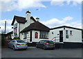
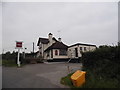
The lifestyle in AL9 6BB is shaped by its village character and proximity to rural and suburban amenities. Residents can access five retail outlets, including Budgens Hatfield and Morrisons Daily Welwyn, providing everyday shopping convenience. The village itself offers historic sites like St Mary’s church, Camfield Place, and The Rose and Crown pub, adding to its charm. While the area lacks large-scale leisure facilities, the nearby rail stations connect to broader networks for dining, entertainment, and cultural activities. The mix of local shops, historic landmarks, and transport links creates a balanced lifestyle, blending rural tranquillity with practical access to urban resources. This makes AL9 6BB appealing to those seeking a peaceful yet connected existence.
Amenities
Schools
The nearest school to AL9 6BB is Essendon CofE (VC) Primary School, a primary institution with a good Ofsted rating. This school serves the village’s younger residents, providing education for children up to Year 6. The absence of secondary schools in the immediate area means families may need to look to nearby towns like Hatfield for secondary education. The presence of a well-rated primary school is a key draw for families, though the lack of local secondary options could be a consideration for those planning long-term in the area. The school’s good rating indicates a commitment to quality education, which aligns with the community’s focus on stability and historic continuity.
| Rank | School | Type | Entry gender | Ages |
|---|
Explore more schools in this area
Go to Schools tabDemographics
The population of AL9 6BB has a median age of 47, with the most common age range being adults aged 30–64. This suggests a mature, settled community, likely with a mix of long-term residents and families. Home ownership stands at 63%, indicating a majority of residents live in properties they own, while the remaining 37% may be in rental or other tenures. The accommodation type is predominantly houses, reflecting a low-density, suburban layout typical of rural Hertfordshire. The predominant ethnic group is White, though no further breakdown of diversity is provided. The age profile and ownership rates suggest a community focused on stability, with fewer young families compared to urban areas. The absence of specific deprivation data means quality of life is inferred from the area’s low environmental risks and access to amenities like schools and rail links.
Household Size
Accommodation Type
Tenure
Ethnic Group
Religion
Household Composition
Age
Household Deprivation
NS-SEC
Explore more demographic insights in this area
Go to Demographics tabPlanning
Planning Constraints
- Flood RiskPremium
- Ramsar Wetland SitesPremium
- Area of Outstanding Natural BeautyPremium
- Protected Nature ReservePremium
- Protected WoodlandPremium