Area Overview for AL9 5SE
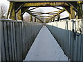
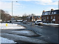
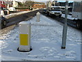
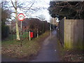
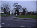
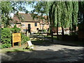
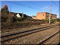
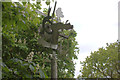
Photos of AL9 5SE
Area Information
AL9 5SE is a small residential cluster in England, home to 1,885 people spread across a compact area with a density of 1,068 people per square kilometre. This makes it a tightly knit community where neighbours are likely to know one another. The area’s demographic profile is defined by adults aged 30–64, with a median age of 47, suggesting a stable, established population. Most residents own their homes, with 70% of properties in private ownership, and the majority of housing is in traditional family homes. The area’s proximity to Hatfield and its surrounding towns offers a balance of suburban tranquillity and access to regional amenities. Nearby, The Ryde School provides a good-rated primary education, while rail links to Hatfield, Welham Green, and Welwyn Garden City ensure easy travel. Daily life here is shaped by a mix of local retail, including Budgens, Co-op, and Iceland, and reliable digital connectivity. With low flood risk and a moderate crime score, AL9 5SE blends practicality with a sense of community, ideal for those seeking a settled lifestyle without sacrificing convenience.
- Area Type
- Postcode
- Area Size
- Not available
- Population
- 1885
- Population Density
- 1068 people/km²
AL9 5SE is primarily an owner-occupied area, with 70% of properties in private hands. The housing stock consists mainly of houses, which are typical for suburban settings and suggest a focus on family homes. This contrasts with areas dominated by rental properties or apartments, where turnover is often higher. The prevalence of houses indicates a market that caters to those seeking long-term stability, rather than short-term tenancies. Given the area’s small size and compact layout, property availability is likely limited, making it a competitive market for buyers. The high home ownership rate also implies that the local economy supports self-employment or stable employment, reducing reliance on rental income. For buyers, this means a focus on purchasing rather than renting, with properties likely to retain value over time. However, the small size of the area may limit options for those seeking larger homes or specific property types.
House Prices in AL9 5SE
No properties found in this postcode.
Energy Efficiency in AL9 5SE
The lifestyle in AL9 5SE is shaped by its proximity to essential amenities, including five retail outlets such as Budgens Hatfield, Co-op Birchwood, and Iceland Hatfield. These shops provide access to groceries, household goods, and everyday essentials, reducing the need for long trips to larger centres. The rail stations nearby add to the area’s convenience, offering direct links to Hatfield and Welwyn Garden City, which host more extensive shopping, dining, and leisure options. While the area itself is compact, the surrounding towns provide a broader range of facilities, from cafes to cultural venues. The combination of local shops and regional transport ensures a balance between self-sufficiency and access to wider opportunities. This makes AL9 5SE appealing to those who value both convenience and the ability to explore beyond their immediate surroundings.
Amenities
Schools
The Ryde School is the primary school closest to AL9 5SE, with an Ofsted rating of ‘Good’. This provides families with a reliable option for early education, though no secondary schools are listed in the data. The presence of a well-rated primary school is a key consideration for parents, as it ensures access to quality education within the local area. The school’s rating suggests a focus on academic standards and student welfare, though further details on curriculum or facilities are not available. For families prioritising education, the proximity of The Ryde School reduces the need for long commutes, aligning with the area’s emphasis on convenience. However, the absence of secondary schooling may require students to travel to nearby towns like Hatfield or Welwyn Garden City, which could be a practical consideration for parents.
| Rank | School | Type | Entry gender | Ages |
|---|
Explore more schools in this area
Go to Schools tabDemographics
The population of AL9 5SE is predominantly adults aged 30–64, with a median age of 47. This suggests a mature, stable community where many residents are likely in their prime working or retirement years. Home ownership is strong, with 70% of properties occupied by their owners, indicating a long-term presence of families and individuals invested in the area. The accommodation type is largely houses, reflecting a preference for private, standalone living spaces. The predominant ethnic group is White, which aligns with broader regional trends in Hertfordshire. While no specific data on deprivation is provided, the high home ownership rate and moderate population density suggest a community with relatively stable economic conditions. The age profile and housing stock imply a focus on family-oriented living, with fewer young families or transient populations. This demographic mix contributes to a cohesive, low-turnover environment where residents are likely to form lasting social ties.
Household Size
Accommodation Type
Tenure
Ethnic Group
Religion
Household Composition
Age
Household Deprivation
NS-SEC
Explore more demographic insights in this area
Go to Demographics tabPlanning
Planning Constraints
- Flood RiskPremium
- Ramsar Wetland SitesPremium
- Area of Outstanding Natural BeautyPremium
- Protected Nature ReservePremium
- Protected WoodlandPremium