Area Overview for AL9 5NR
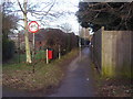
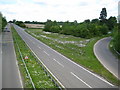
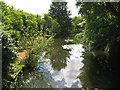
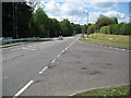
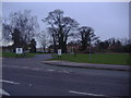
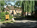
Photos of AL9 5NR


Area Information
Living in AL9 5NR means being part of a small, tightly knit residential cluster in England, where the population of 1,747 spreads across a low-density area of 91 people per square kilometre. This postcode is characterised by its quiet, suburban charm, with a focus on family-oriented living. The area is served by nearby amenities such as Tesco Hatfield and Co-op Birchwood, offering everyday convenience. Residents benefit from proximity to multiple railway stations, including Hatfield and Welwyn Garden City, which connect to major urban centres. The community is predominantly composed of adults aged 30–64, with a median age of 47, suggesting a stable, mature demographic. While the area lacks large-scale commercial hubs, its compact size fosters a sense of familiarity and accessibility. The presence of Essendon CofE (VC) Primary School, rated ‘good’ by Ofsted, adds to its appeal for families. AL9 5NR balances seclusion with practical connectivity, making it a viable choice for those seeking a quieter lifestyle without sacrificing access to essential services.
- Area Type
- Postcode
- Area Size
- Not available
- Population
- 1747
- Population Density
- 91 people/km²
The property market in AL9 5NR is defined by a 63% home ownership rate, with houses making up the majority of accommodation types. This suggests a market skewed towards owner-occupation rather than rental properties, which is typical of suburban areas with a mature demographic. The prevalence of houses over flats indicates a focus on family-friendly housing, likely appealing to those seeking space and privacy. Given the area’s small size, the housing stock is limited, which may drive competition among buyers. However, the lack of planning constraints such as AONB or protected woodland coverage means development restrictions are minimal. For prospective buyers, this translates to a manageable but niche market, where properties are likely to retain value due to their scarcity. The proximity to transport links and amenities further enhances the appeal of homes in this area, though buyers should consider the limited scale of the local market.
House Prices in AL9 5NR
No properties found in this postcode.
Energy Efficiency in AL9 5NR
Daily life in AL9 5NR is shaped by its proximity to essential amenities within practical reach. Retail options include major chains like Tesco Hatfield and Co-op Birchwood, ensuring residents have access to groceries and everyday goods without long journeys. The area’s railway stations, such as Hatfield and Welwyn Garden City, provide direct links to broader transport networks, enhancing mobility for shopping, work, or leisure. While the data does not list parks or leisure facilities, the absence of planning constraints like AONB or protected woodlands suggests open spaces may exist nearby. The presence of a ‘good’-rated primary school further enriches the community, supporting family life. Overall, the combination of retail, transport, and educational infrastructure offers a functional lifestyle, ideal for those prioritising convenience and connectivity in a low-key setting.
Amenities
Schools
The nearest school to AL9 5NR is Essendon CofE (VC) Primary School, which serves the local community with a ‘good’ Ofsted rating. This primary school is a key asset for families, offering a solid foundation for early education. The absence of secondary schools in the immediate vicinity means students may need to travel to nearby towns for higher education, but the primary school’s quality mitigates this concern. The school’s rating suggests a commitment to academic standards and pastoral care, which is crucial for parents prioritising educational outcomes. With no other schools listed in the data, the area’s educational offerings are centred around this single institution, making it a critical factor in the decision to live in AL9 5NR.
| Rank | School | Type | Entry gender | Ages |
|---|
Explore more schools in this area
Go to Schools tabDemographics
The community in AL9 5NR is predominantly composed of adults aged 30–64, with a median age of 47. This suggests a population that is largely settled, with fewer young families or retirees compared to other areas. Home ownership rates stand at 63%, indicating a mix of long-term residents and buyers seeking stable housing. The accommodation type is primarily houses, reflecting a preference for single-family dwellings over flats or apartments. The predominant ethnic group is White, with no specific data provided on minority representation. While no deprivation data is explicitly stated, the moderate population density and availability of essential services suggest a quality of life that supports daily needs. The absence of significant demographic diversity or younger age groups may influence the social dynamics, leaning towards a more conservative, established community.
Household Size
Accommodation Type
Tenure
Ethnic Group
Religion
Household Composition
Age
Household Deprivation
NS-SEC
Explore more demographic insights in this area
Go to Demographics tabPlanning
Planning Constraints
- Flood RiskPremium
- Ramsar Wetland SitesPremium
- Area of Outstanding Natural BeautyPremium
- Protected Nature ReservePremium
- Protected WoodlandPremium