Area Overview for AL9 5FA
Photos of AL9 5FA

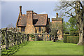
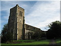
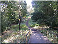


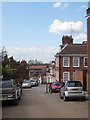
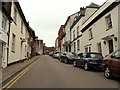
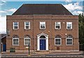
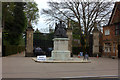


100 photos from this area
Area Information
Key information about the AL9 5FA including its size, population, and administrative classification.
- Area Type
- Postcode
- Area Size
- 8033 m²
- Population
- 1885
- Population Density
- 1068 people/km²
House Prices in AL9 5FA
23
Properties
£282,318
Average Sold Price
£29,497
Lowest Price
£361,000
Highest Price
Showing 23 properties
| Address | Type | Beds | Baths | Last Sale Price | Last Sale Date | |
|---|---|---|---|---|---|---|
| 1, Parkgate House, Great North Road, Hatfield, AL9 5FA | Flat | 2 | 2 | £29,497 | Dec 2024 | |
| 22, Parkgate House, Great North Road, Hatfield, AL9 5FA | Flat | - | - | £325,000 | Aug 2023 | |
| 21, Parkgate House, Great North Road, Hatfield, AL9 5FA | Flat | - | - | £262,500 | Dec 2022 | |
| 11, Parkgate House, Great North Road, Hatfield, AL9 5FA | Flat | 1 | 1 | £250,000 | Dec 2022 | |
| 20, Parkgate House, Great North Road, Hatfield, AL9 5FA | Flat | 1 | 1 | £256,000 | Oct 2022 | |
| 19, Parkgate House, Great North Road, Hatfield, AL9 5FA | Flat | - | - | £320,000 | Aug 2022 | |
| 12, Parkgate House, Great North Road, Hatfield, AL9 5FA | Flat | 1 | 1 | £245,000 | Jul 2022 | |
| 15, Parkgate House, Great North Road, Hatfield, AL9 5FA | Flat | 2 | 2 | £347,000 | May 2022 | |
| 3, Parkgate House, Great North Road, Hatfield, AL9 5FA | Flat | 2 | 2 | £300,000 | May 2022 | |
| 23, Parkgate House, Great North Road, Hatfield, AL9 5FA | Flat | 2 | 1 | £350,000 | Sep 2020 |
Page 1 of 3
Energy Efficiency in AL9 5FA
Amenities
Schools
| Rank | School | Type | Entry gender | Ages |
|---|
Explore more schools in this area
Go to Schools tabDemographics
Household Size
Two person
most common
Accommodation Type
Houses
most common
Tenure
70
majority
Ethnic Group
White
most common
Religion
N/A
most common
Household Composition
N/A
most common
Age
47
median
Adults (30-64 years)
most common
Household Deprivation
N/A
with no deprivation
NS-SEC
51
in Lower managerial occupations
Explore more demographic insights in this area
Go to Demographics tabPlanning
Planning Constraints
- Flood RiskPremium
- Ramsar Wetland SitesPremium
- Area of Outstanding Natural BeautyPremium
- Protected Nature ReservePremium
- Protected WoodlandPremium