Area Overview for AL9 5AW
Photos of AL9 5AW
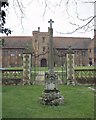
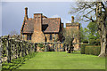
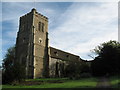
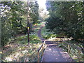
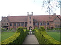
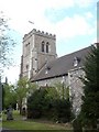
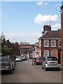
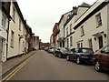
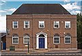
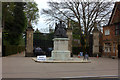
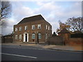
100 photos from this area
Area Information
Key information about the AL9 5AW including its size, population, and administrative classification.
- Area Type
- Postcode
- Area Size
- 5023 m²
- Population
- 1747
- Population Density
- 91 people/km²
House Prices in AL9 5AW
21
Properties
£334,769
Average Sold Price
£105,000
Lowest Price
£780,000
Highest Price
Showing 21 properties
| Address | Type | Beds | Baths | Last Sale Price | Last Sale Date | |
|---|---|---|---|---|---|---|
| 36 Church Street, Hatfield, AL9 5AW | Terraced | 3 | 1 | £455,000 | Jun 2025 | |
| 14 Church Street, Hatfield, AL9 5AW | Terraced | 2 | 2 | £430,000 | Oct 2024 | |
| 10 Church Street, Hatfield, AL9 5AW | house | 2 | 1 | £318,000 | Feb 2023 | |
| 16 Church Street, Hatfield, AL9 5AW | house | 2 | - | £410,000 | Feb 2019 | |
| 24 Church Street, Hatfield, AL9 5AW | Semi-detached | - | - | £780,000 | Sep 2014 | |
| 34 Church Street, Hatfield, AL9 5AW | Terraced | 3 | - | £321,000 | Oct 2013 | |
| 8 Church Street, Hatfield, AL9 5AW | Semi-detached | 2 | - | £250,000 | Aug 2013 | |
| 28 Church Street, Hatfield, AL9 5AW | house | 2 | - | £310,000 | May 2012 | |
| 26 Church Street, Hatfield, AL9 5AW | house | - | - | £285,000 | Mar 2010 | |
| 20 Church Street, Hatfield, AL9 5AW | Semi-detached | - | - | £250,000 | Feb 2007 |
Page 1 of 3
Energy Efficiency in AL9 5AW
Amenities
Schools
| Rank | School | Type | Entry gender | Ages |
|---|
Explore more schools in this area
Go to Schools tabDemographics
Household Size
Two person
most common
Accommodation Type
Houses
most common
Tenure
63
majority
Ethnic Group
White
most common
Religion
N/A
most common
Household Composition
N/A
most common
Age
47
median
Adults (30-64 years)
most common
Household Deprivation
N/A
with no deprivation
NS-SEC
45
in Lower managerial occupations
Explore more demographic insights in this area
Go to Demographics tabPlanning
Planning Constraints
- Flood RiskPremium
- Ramsar Wetland SitesPremium
- Area of Outstanding Natural BeautyPremium
- Protected Nature ReservePremium
- Protected WoodlandPremium