Area Overview for AL9 5AU
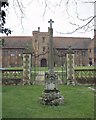
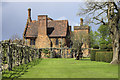
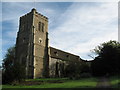
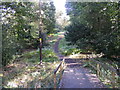
Photos of AL9 5AU

Area Information
Living in AL9 5AU means being part of a compact, residential community in England’s Hertfordshire region. With a population of 1,747 and a density of 91 people per square kilometre, this postcode area is small but well-served by essential amenities. The area’s character is shaped by its proximity to Hatfield, a town known for its historical roots and modern infrastructure. Daily life here balances suburban tranquillity with practical access to transport and retail. Residents benefit from nearby rail stations, including Hatfield and Welham Green, which connect to larger cities like London and Luton. The area’s low flood risk and absence of protected natural sites suggest a stable, low-constraint environment. However, crime rates are around average, requiring standard security measures. AL9 5AU is ideal for those seeking a settled, community-focused lifestyle with easy access to both local services and regional hubs.
- Area Type
- Postcode
- Area Size
- Not available
- Population
- 1747
- Population Density
- 91 people/km²
The property market in AL9 5AU is characterised by a high rate of home ownership (63%) and a focus on houses rather than flats or apartments. This suggests a community prioritising family-friendly, long-term living over rental properties. The predominance of houses may indicate limited high-density development, which could make the area appealing to buyers seeking spacious, traditional homes. However, the small population and compact size of the postcode mean the housing stock is unlikely to be vast. Buyers should consider nearby areas for broader options, though AL9 5AU’s proximity to Hatfield’s rail network and retail hubs may offset its limited local supply. The market appears stable, with no immediate planning constraints or environmental risks affecting property values.
House Prices in AL9 5AU
No properties found in this postcode.
Energy Efficiency in AL9 5AU
The lifestyle in AL9 5AU is defined by practical convenience and community access. Nearby retail options like Budgens Hatfield, Iceland Hatfield, and Asda Hatfield cater to daily needs, while rail stations offer swift travel to regional and urban centres. Though the area itself is small, its integration with Hatfield’s amenities ensures residents can enjoy a range of services without long commutes. The presence of a well-rated primary school and low environmental risks contribute to a balanced quality of life. While parks and leisure facilities are not explicitly listed, the area’s proximity to Hatfield’s town centre likely provides additional recreational opportunities. This blend of local convenience and regional connectivity makes AL9 5AU suitable for those valuing a self-contained yet flexible lifestyle.
Amenities
Schools
The nearest school to AL9 5AU is Essendon CofE (VC) Primary School, which serves the local community with a good Ofsted rating. This primary school is a key asset for families, offering a reliable foundation for early education. While no secondary schools are listed in the data, the presence of a well-rated primary suggests the area is likely within reach of other educational institutions in Hatfield. The school’s rating indicates a commitment to quality teaching, though parents may need to explore further for secondary options. The mix of school types—primarily primary—reflects the area’s demographic focus on families with younger children, making it a practical choice for those prioritising early education.
| Rank | School | Type | Entry gender | Ages |
|---|
Explore more schools in this area
Go to Schools tabDemographics
AL9 5AU’s population skews towards adults aged 30–64, with a median age of 47. This suggests a mature, established community, likely with a strong presence of families and professionals. Home ownership stands at 63%, indicating a mix of long-term residents and buyers seeking stability. The area is predominantly composed of houses, reflecting a traditional, low-density housing stock. The White ethnic group is the largest demographic, though no specific data on diversity or deprivation is provided. With a population density of 91 people per square kilometre, the area avoids overcrowding, offering a balance between privacy and proximity to amenities. This profile aligns with a community that values settled living, with fewer transient residents compared to more urban areas.
Household Size
Accommodation Type
Tenure
Ethnic Group
Religion
Household Composition
Age
Household Deprivation
NS-SEC
Explore more demographic insights in this area
Go to Demographics tabPlanning
Planning Constraints
- Flood RiskPremium
- Ramsar Wetland SitesPremium
- Area of Outstanding Natural BeautyPremium
- Protected Nature ReservePremium
- Protected WoodlandPremium