Area Overview for AL8 7SW
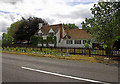
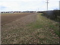
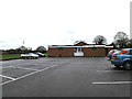
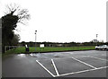
Photos of AL8 7SW

Area Information
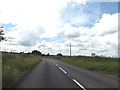
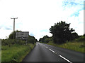
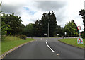
Living in AL8 7SW means being part of a small, tightly knit residential cluster in England, where the population of 1,548 people spreads across a low-density area of 122 people per square kilometre. This postcode sits within the broader context of Hatfield and surrounding towns, offering a blend of suburban comfort and practical connectivity. The area is defined by its modest scale, with homes predominantly in private ownership, reflecting a community that values stability. Daily life here is shaped by proximity to nearby towns, with rail links and retail hubs within reach. While AL8 7SW itself is compact, it benefits from being near larger centres like Welwyn Garden City and Hatfield, which offer more extensive amenities. The demographic profile—skewed toward adults aged 30–64—suggests a mature, established population, many of whom may have raised families in the area. This is a place where quiet living meets accessibility, with no major environmental constraints or planning restrictions to complicate life. For buyers, it’s a chance to own a home in a low-risk, low-crime environment, with broadband and mobile coverage rated as excellent and good respectively.
- Area Type
- Postcode
- Area Size
- Not available
- Population
- 1548
- Population Density
- 122 people/km²
The property market in AL8 7SW is characterised by high home ownership—75% of residents own their homes—which suggests a strong preference for long-term residency over rental living. The accommodation type is predominantly houses, reflecting a suburban or semi-rural setting with larger properties. This contrasts with areas dominated by apartments or terraced housing, which are more common in denser urban zones. The small population and low density of 122 people per square kilometre indicate that AL8 7SW is not a high-pressure market with rapid price fluctuations. Buyers should consider that the limited number of properties and the focus on owner-occupation may mean fewer opportunities for investment or speculative purchase. The area’s proximity to rail links and retail hubs like Tesco Hatfield and Sainsburys Welwyn could enhance its appeal, but the small scale of the postcode means the immediate surroundings are key to assessing property value trends.
House Prices in AL8 7SW
No properties found in this postcode.
Energy Efficiency in AL8 7SW
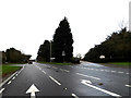
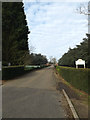
The lifestyle in AL8 7SW is shaped by its proximity to retail and transport hubs. Within practical reach are five retail outlets, including major chains like Tesco Hatfield and Sainsburys Welwyn, ensuring everyday shopping needs are easily met. The area’s rail connections—five stations in total—offer access to Welwyn Garden City, Hatfield, and beyond, facilitating both local and regional travel. While the data does not mention parks or leisure facilities directly, the absence of planning constraints like AONBs or protected woodlands suggests open spaces may be available nearby. The presence of a single primary school and the low population density imply a quieter, less congested environment. For residents, this balance of practical amenities and accessible transport creates a lifestyle that prioritises convenience without sacrificing the tranquillity of a small residential cluster.
Amenities
Schools
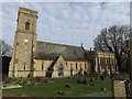
The nearest school to AL8 7SW is St John’s Voluntary Aided Church of England Primary School in Lemsford, which serves the local community with a primary education offering. The school holds an Ofsted rating of ‘good’, indicating it meets or exceeds national standards in teaching quality and student outcomes. While no secondary schools are listed in the data, the presence of a well-rated primary school is a significant factor for families. The single school in the area suggests a focus on primary education, which may require families to consider commuting for secondary schooling. However, the ‘good’ rating implies that the school provides a reliable foundation for younger children, reducing the need for additional private schooling. For those prioritising education, the proximity of St John’s to AL8 7SW is a clear advantage, though broader school options in nearby towns like Hatfield may also be worth exploring.
| Rank | School | Type | Entry gender | Ages |
|---|
Explore more schools in this area
Go to Schools tabDemographics
The community in AL8 7SW is predominantly composed of adults aged 30–64, with a median age of 47. This suggests a mature population, likely with long-term ties to the area. Home ownership is high at 75%, indicating a stable, owner-occupied demographic rather than a transient rental market. The accommodation type is largely houses, which aligns with the low population density and the character of a small residential cluster. The predominant ethnic group is White, though specific data on diversity or deprivation is not provided. The absence of detailed diversity metrics means the community’s social composition remains less defined in the data. However, the age profile and ownership figures imply a settled, family-oriented environment. With no mention of deprivation or socioeconomic challenges in the provided data, it’s reasonable to infer that the area supports a quality of life consistent with its low crime rates and good connectivity.
Household Size
Accommodation Type
Tenure
Ethnic Group
Religion
Household Composition
Age
Household Deprivation
NS-SEC
Explore more demographic insights in this area
Go to Demographics tabPlanning
Planning Constraints
- Flood RiskPremium
- Ramsar Wetland SitesPremium
- Area of Outstanding Natural BeautyPremium
- Protected Nature ReservePremium
- Protected WoodlandPremium