Area Overview for AL8 7HD
Photos of AL8 7HD
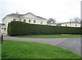
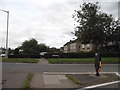
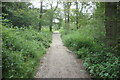
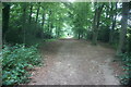
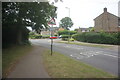
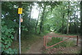
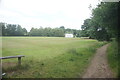
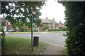
28 photos from this area
Area Information
Key information about the AL8 7HD including its size, population, and administrative classification.
- Area Type
- Postcode
- Area Size
- 1.4 hectares
- Population
- 1474
- Population Density
- 4827 people/km²
House Prices in AL8 7HD
26
Properties
£314,125
Average Sold Price
£88,250
Lowest Price
£448,000
Highest Price
Showing 26 properties
| Address | Type | Beds | Baths | Last Sale Price | Last Sale Date | |
|---|---|---|---|---|---|---|
| 150 Knightsfield, Welwyn Garden City, AL8 7HD | house | - | - | £448,000 | Oct 2025 | |
| 108 Knightsfield, Welwyn Garden City, AL8 7HD | Maisonette | - | - | £270,000 | Jun 2021 | |
| 136 Knightsfield, Welwyn Garden City, AL8 7HD | house | - | - | £365,000 | May 2021 | |
| 124 Knightsfield, Welwyn Garden City, AL8 7HD | house | - | - | £375,000 | Oct 2020 | |
| 142 Knightsfield, Welwyn Garden City, AL8 7HD | Semi-detached | 3 | 1 | £375,000 | Sep 2020 | |
| 112 Knightsfield, Welwyn Garden City, AL8 7HD | Maisonette | - | - | £250,000 | Jun 2019 | |
| 128 Knightsfield, Welwyn Garden City, AL8 7HD | Terraced | 3 | 1 | £390,000 | Nov 2018 | |
| 144 Knightsfield, Welwyn Garden City, AL8 7HD | Semi-detached | 3 | - | £370,000 | Jun 2016 | |
| 122 Knightsfield, Welwyn Garden City, AL8 7HD | Flat | - | - | £210,000 | Nov 2009 | |
| 138 Knightsfield, Welwyn Garden City, AL8 7HD | Terraced | - | - | £88,250 | Jun 1999 |
Page 1 of 3
Energy Efficiency in AL8 7HD
Amenities
Schools
| Rank | School | Type | Entry gender | Ages |
|---|
Explore more schools in this area
Go to Schools tabDemographics
Household Size
Family (3-5 people)
most common
Accommodation Type
Houses
most common
Tenure
52
majority
Ethnic Group
White
most common
Religion
N/A
most common
Household Composition
N/A
most common
Age
47
median
Adults (30-64 years)
most common
Household Deprivation
N/A
with no deprivation
NS-SEC
41
in Lower managerial occupations
Explore more demographic insights in this area
Go to Demographics tabPlanning
Planning Constraints
- Flood RiskPremium
- Ramsar Wetland SitesPremium
- Area of Outstanding Natural BeautyPremium
- Protected Nature ReservePremium
- Protected WoodlandPremium