Area Overview for AL8 7DB
Photos of AL8 7DB
Area Information
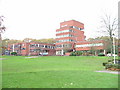
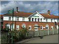
Living in AL8 7DB means inhabiting a tightly knit residential cluster within Sherrards Ward, part of the Welwyn Hatfield Borough in Hertfordshire. With a population of 1,349 spread across a compact area, this postcode is characterised by high population density — 1,045 people per square kilometre. The area’s history is deeply rooted in its namesake, Sherrards mansion, a Victorian-era home that predates Welwyn Garden City’s founding. Today, the community is predominantly composed of adults aged 30–64, with a median age of 47. Daily life here balances suburban tranquillity with proximity to amenities like railway stations and retail hubs. The area’s small size fosters a sense of familiarity, though its limited scope means residents often look beyond AL8 7DB for broader opportunities. The absence of major planning constraints or environmental risks, coupled with low crime rates, makes it an appealing choice for those seeking a stable, low-maintenance lifestyle. However, the compact nature of the area means housing options are finite, requiring buyers to consider nearby zones for expansion.
- Area Type
- Postcode
- Area Size
- Not available
- Population
- 1349
- Population Density
- 1045 people/km²
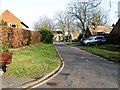
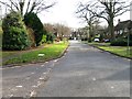
The property market in AL8 7DB is dominated by owner-occupied homes, with 88% of properties owned by residents rather than rented. This high rate of home ownership suggests a stable, long-term community with little turnover. The accommodation type is exclusively houses, not flats, which is unusual for a small postcode area but aligns with the demographic profile of older, family-oriented residents. The limited size of AL8 7DB means the housing stock is finite, and buyers may need to look beyond the postcode for additional options. The absence of planning constraints or environmental restrictions — such as protected woodlands or Areas of Outstanding Natural Beauty — makes the area more attractive for those seeking straightforward property transactions. However, the small scale of the area may mean limited scope for development, which could affect future property value growth.
House Prices in AL8 7DB
No properties found in this postcode.
Energy Efficiency in AL8 7DB
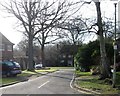
Residents of AL8 7DB have access to a range of local amenities within practical reach. The area is served by five retail outlets, including Co-op Knightsfield, Waitrose Welwyn, and Tesco Shire, offering everyday shopping needs. Nearby railway stations — Welwyn Garden City, Welwyn North, and Hatfield — provide easy access to regional transport networks. While the data does not list parks or leisure facilities explicitly, the absence of planning constraints like protected woodlands or nature reserves suggests open spaces may be available nearby. The compact nature of the area means amenities are concentrated, reducing travel time for essentials. However, those seeking extensive recreational options may need to explore further afield, as the data does not highlight specific parks or leisure venues.
Amenities
Schools
The nearest school to AL8 7DB is Templewood Primary School, which serves the local community with a primary education offering. It holds a ‘good’ Ofsted rating, indicating a satisfactory standard of teaching and facilities. While no secondary schools are listed in the data, the presence of a primary school suggests that families with younger children may find the area suitable for early education. However, those requiring secondary schooling may need to look further afield, as the area’s small size does not accommodate multiple educational institutions. The single school option could be a consideration for parents seeking a broader range of educational choices, though the proximity to Welwyn Garden City — a larger town — may offer additional opportunities.
| Rank | School | Type | Entry gender | Ages |
|---|
Explore more schools in this area
Go to Schools tabDemographics
AL8 7DB’s population skews heavily towards adults aged 30–64, reflecting a median age of 47. This suggests a mature, established community with a strong presence of middle-aged households. Home ownership is exceptionally high at 88%, indicating a stable, long-term resident base with fewer renters. The area is predominantly composed of houses, not flats, aligning with the demographic profile of older, family-oriented residents. The predominant ethnic group is White, with no specific data on minority representation provided. The high home ownership rate and age profile suggest a community prioritising security and permanence over transient living. While deprivation data is not explicitly stated, the low crime score of 72 (on a 100-point scale, with lower scores indicating less risk) implies a relatively high quality of life, though the area’s small size may limit access to specialist services or cultural diversity.
Household Size
Accommodation Type
Tenure
Ethnic Group
Religion
Household Composition
Age
Household Deprivation
NS-SEC
Explore more demographic insights in this area
Go to Demographics tabPlanning
Planning Constraints
- Flood RiskPremium
- Ramsar Wetland SitesPremium
- Area of Outstanding Natural BeautyPremium
- Protected Nature ReservePremium
- Protected WoodlandPremium