Area Overview for AL8 6XF
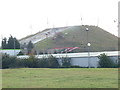
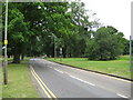
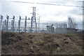
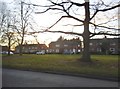
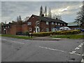
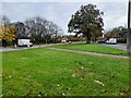
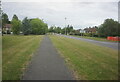
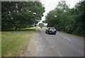
Photos of AL8 6XF
Area Information
AL8 6XF is a small, densely populated postcode area in Hertfordshire, covering 31.9 hectares and home to 1,687 residents. With a population density of 1,462 people per square kilometre, this compact cluster of homes reflects a tight-knit community. The area’s demographic profile suggests a mature population, with a median age of 47 and the majority of residents falling within the 30–64 age range. This hints at a stable, established neighbourhood where many households are long-term residents. Daily life here is shaped by proximity to essential services, including multiple retail outlets and rail connections. While the area lacks detailed historical or cultural context, its practical amenities and connectivity make it a viable choice for those prioritising convenience and accessibility over expansive green spaces or historic landmarks. The high broadband score of 99 ensures seamless digital connectivity, supporting remote work and online activities, though mobile coverage is slightly lower at 85. For buyers, AL8 6XF offers a snapshot of suburban living with a focus on functional infrastructure and community-centric living.
- Area Type
- Postcode
- Area Size
- 31.9 hectares
- Population
- 1687
- Population Density
- 1462 people/km²
The property market in AL8 6XF is characterised by a strong presence of owner-occupied homes, with 61% of properties in private hands. This suggests a stable market where long-term residents are more common than renters. The predominant accommodation type is houses, which may indicate a focus on family-friendly housing stock. Given the area’s small size and high population density, the housing stock is likely limited, with little scope for new developments. Buyers should consider that the compact nature of AL8 6XF means proximity to amenities and transport is a key selling point. However, the lack of detailed data on property prices or rental demand means the market’s full potential remains unclear. For those seeking a home, the emphasis on houses and owner-occupation suggests a community prioritising permanence over transient living, though the limited size of the area may restrict options for buyers seeking larger properties or more space.
House Prices in AL8 6XF
Showing 3 properties
| Address | Type | Beds | Baths | Last Sale Price | Last Sale Date | |
|---|---|---|---|---|---|---|
| Former The Lodge Police Headquarters, Stanborough Road, Welwyn Garden City, AL8 6XF | undefined | - | - | - | - | |
| Boat House, Stanborough Park, Stanborough Road, Welwyn Garden City, AL8 6XF | office_workshop | - | - | - | - | |
| Site Offices At, Police Headquarters, Stanborough Road, Welwyn Garden City, AL8 6XF | Office | - | - | - | - |
Energy Efficiency in AL8 6XF
Residents of AL8 6XF benefit from a range of nearby amenities that support everyday living. The area’s retail landscape includes major chains such as Tesco Hatfield, Budgens Welwyn, and Co-op Welwyn, providing access to groceries, household essentials, and convenience services. These stores are within walking or short driving distance, enhancing the practicality of daily errands. The proximity to multiple rail stations also means residents can easily access broader leisure and employment opportunities beyond the immediate area. While the data does not specify parks or recreational facilities, the absence of protected natural areas suggests that green spaces may be limited. Nonetheless, the combination of retail options and transport links ensures a lifestyle focused on convenience and accessibility, with minimal need to travel far for shopping, commuting, or social activities.
Amenities
Schools
Residents of AL8 6XF have access to a range of educational institutions, including Stanborough School, which operates as both a primary school and an academy with a good Ofsted rating. This dual role ensures it serves children from early education through to secondary schooling. Nearby, Lakeside School provides special education services, catering to students with specific learning needs. The combination of a primary academy and a special school suggests a well-rounded educational ecosystem for families. The presence of Stanborough School, rated good by Ofsted, indicates a reliable standard of teaching and facilities. However, the absence of secondary schools in the immediate vicinity may require families to look further afield for comprehensive education. For parents, the availability of both mainstream and special education options offers flexibility, though the limited number of schools underscores the need for careful planning when considering the area for long-term residency.
| Rank | School | Type | Entry gender | Ages |
|---|
Explore more schools in this area
Go to Schools tabDemographics
The community in AL8 6XF is predominantly composed of adults aged 30–64, reflecting a mature population with a median age of 47. Home ownership is strong, with 61% of residents living in owner-occupied properties, suggesting a stable housing market. The accommodation type is primarily houses, indicating a mix of family homes and single-family residences. The predominant ethnic group is White, which aligns with broader regional demographics in Hertfordshire. The high population density of 1,462 people per square kilometre underscores the area’s compact nature, where housing is closely packed. This density may influence local dynamics, fostering a sense of familiarity among residents. However, the absence of detailed data on deprivation or income levels means the full picture of quality of life remains partially obscured. Nonetheless, the demographic profile suggests a community focused on established living, with limited turnover and a preference for long-term residency.
Household Size
Accommodation Type
Tenure
Ethnic Group
Religion
Household Composition
Age
Household Deprivation
NS-SEC
Explore more demographic insights in this area
Go to Demographics tabPlanning
Planning Constraints
- Flood RiskPremium
- Ramsar Wetland SitesPremium
- Area of Outstanding Natural BeautyPremium
- Protected Nature ReservePremium
- Protected WoodlandPremium