Area Overview for AL8 6RF
Photos of AL8 6RF
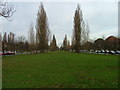
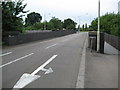

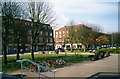
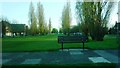
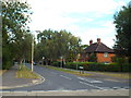
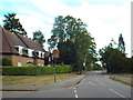

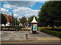
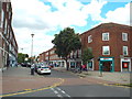


81 photos from this area
Area Information
Key information about the AL8 6RF including its size, population, and administrative classification.
- Area Type
- Postcode
- Area Size
- 1.1 hectares
- Population
- 1857
- Population Density
- 2925 people/km²
House Prices in AL8 6RF
55
Properties
£282,925
Average Sold Price
£86,500
Lowest Price
£432,000
Highest Price
Showing 55 properties
| Address | Type | Beds | Baths | Last Sale Price | Last Sale Date | |
|---|---|---|---|---|---|---|
| 4 Guessens Grove, Welwyn Garden City, AL8 6RF | Terraced | 3 | 1 | £432,000 | Dec 2022 | |
| 9 Guessens Grove, Welwyn Garden City, AL8 6RF | house | - | - | £405,000 | May 2021 | |
| 12 Guessens Grove, Welwyn Garden City, AL8 6RF | Retail | 3 | 1 | £416,000 | Feb 2021 | |
| 14 Guessens Grove, Welwyn Garden City, AL8 6RF | house | - | - | £400,000 | Nov 2019 | |
| 11 Guessens Grove, Welwyn Garden City, AL8 6RF | Terraced | 3 | - | £399,000 | Mar 2016 | |
| 6 Guessens Grove, Welwyn Garden City, AL8 6RF | house | - | - | £370,000 | Jan 2016 | |
| 7 Guessens Grove, Welwyn Garden City, AL8 6RF | Terraced | 3 | 1 | £330,000 | Jun 2015 | |
| 19 Guessens Grove, Welwyn Garden City, AL8 6RF | Terraced | 3 | 3 | £308,000 | Jan 2015 | |
| 18 Guessens Grove, Welwyn Garden City, AL8 6RF | house | - | - | £245,000 | Feb 2011 | |
| 5 Guessens Grove, Welwyn Garden City, AL8 6RF | house | - | - | £210,000 | Feb 2009 |
Page 1 of 6
Energy Efficiency in AL8 6RF
Amenities
Schools
| Rank | School | Type | Entry gender | Ages |
|---|
Explore more schools in this area
Go to Schools tabDemographics
Household Size
One person
most common
Accommodation Type
Flats
most common
Tenure
50
majority
Ethnic Group
White
most common
Religion
N/A
most common
Household Composition
N/A
most common
Age
47
median
Adults (30-64 years)
most common
Household Deprivation
N/A
with no deprivation
NS-SEC
46
in Lower managerial occupations
Explore more demographic insights in this area
Go to Demographics tabPlanning
Planning Constraints
- Flood RiskPremium
- Ramsar Wetland SitesPremium
- Area of Outstanding Natural BeautyPremium
- Protected Nature ReservePremium
- Protected WoodlandPremium