Area Overview for AL7 9AF
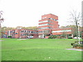
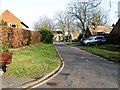
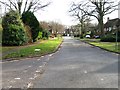
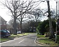
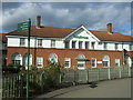
Photos of AL7 9AF


Area Information
Living in AL7 9AF means being part of a small, tightly knit residential cluster in Hertfordshire, with a population of just 1,857 residents. This postcode sits within the Welwyn Hatfield district, a commuter-focused area with easy access to nearby towns and London. The area’s character is defined by its modest scale and practical layout, catering to families and professionals seeking a quieter lifestyle. With a median age of 47, the community is predominantly composed of adults aged 30–64, reflecting a stable, mature demographic. The presence of multiple rail stations, including Welwyn Garden City and Hatfield, ensures strong connectivity to regional hubs. While the area lacks historical or cultural landmarks, its proximity to retail and transport infrastructure makes it a functional base for daily life. The low flood risk and absence of environmental constraints like AONB or protected woodlands suggest a straightforward living environment, though the high crime risk score of 1/100 demands caution. AL7 9AF is not a place for those seeking luxury or novelty—it is a pragmatic choice for those prioritising accessibility and simplicity.
- Area Type
- Postcode
- Area Size
- Not available
- Population
- 1857
- Population Density
- 2925 people/km²
The property market in AL7 9AF is characterised by a 50% home ownership rate, indicating a roughly equal split between owner-occupied and rental properties. The accommodation type is overwhelmingly flats, which suggests a housing stock designed for efficiency rather than spaciousness. This configuration may appeal to professionals or families seeking low-maintenance living, though it also limits options for those prioritising larger homes. Given the area’s small size and limited development, the market is likely constrained by supply, with little scope for new builds or significant price fluctuations. Buyers should consider that flats in this area may be more suited to those with specific needs, such as proximity to transport or lower maintenance costs. The absence of data on property prices or rental yields means the financial viability of purchasing or renting here remains speculative. However, the presence of multiple rail stations nearby could enhance the area’s appeal for commuters.
House Prices in AL7 9AF
No properties found in this postcode.
Energy Efficiency in AL7 9AF
Residents of AL7 9AF have access to a range of practical amenities, including five retail outlets such as Waitrose Welwyn, Sainsburys Welwyn, and Iceland Welwyn. These stores provide everyday shopping convenience, from groceries to household essentials. The proximity to rail stations—Welwyn Garden City, Welwyn North, and Hatfield—enhances mobility, allowing quick travel to nearby towns or London. While the area lacks detailed information on parks or leisure facilities, the retail and transport infrastructure suggests a lifestyle focused on functionality rather than leisure. The presence of multiple supermarkets indicates a community that prioritises accessibility and self-sufficiency. For those seeking a quiet, low-maintenance existence, AL7 9AF offers the basics: shopping, transport, and a stable, mature demographic. However, the absence of cultural or recreational amenities means residents may need to travel further for entertainment or social activities.
Amenities
Schools
| Rank | School | Type | Entry gender | Ages |
|---|
Explore more schools in this area
Go to Schools tabDemographics
The community in AL7 9AF is predominantly composed of adults aged 30–64, with a median age of 47. This suggests a population of established professionals and families, rather than students or retirees. Home ownership sits at 50%, indicating a balanced mix of owner-occupied and rental properties. The accommodation type is almost exclusively flats, reflecting a housing stock tailored to smaller households or those seeking manageable living spaces. The predominant ethnic group is White, with no specific data provided on other demographics. The absence of detailed information on deprivation or socioeconomic diversity means the area’s quality of life cannot be fully assessed through this lens. However, the age profile and home ownership rate suggest a stable, middle-aged population with moderate financial commitments. The lack of data on household composition or income levels means broader conclusions about the community’s needs or challenges remain unconfirmed.
Household Size
Accommodation Type
Tenure
Ethnic Group
Religion
Household Composition
Age
Household Deprivation
NS-SEC
Explore more demographic insights in this area
Go to Demographics tabPlanning
Planning Constraints
- Flood RiskPremium
- Ramsar Wetland SitesPremium
- Area of Outstanding Natural BeautyPremium
- Protected Nature ReservePremium
- Protected WoodlandPremium