Area Overview for AL7 4RZ
Photos of AL7 4RZ


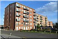
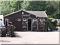
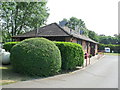
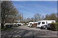


13 photos from this area
Area Information
Key information about the AL7 4RZ including its size, population, and administrative classification.
- Area Type
- Postcode
- Area Size
- 6.8 hectares
- Population
- 2291
- Population Density
- 5014 people/km²
House Prices in AL7 4RZ
33
Properties
£354,250
Average Sold Price
£159,950
Lowest Price
£525,000
Highest Price
Showing 33 properties
| Address | Type | Beds | Baths | Last Sale Price | Last Sale Date | |
|---|---|---|---|---|---|---|
| 81 The Commons, Welwyn Garden City, AL7 4RZ | Semi-detached | 3 | 1 | £425,000 | Aug 2024 | |
| 123 The Commons, Welwyn Garden City, AL7 4RZ | Semi-detached | 3 | 1 | £525,000 | Mar 2023 | |
| 71 The Commons, Welwyn Garden City, AL7 4RZ | Semi-detached | 3 | 1 | £435,000 | Mar 2023 | |
| 67 The Commons, Welwyn Garden City, AL7 4RZ | Retail | 3 | 1 | £480,000 | Oct 2022 | |
| 105 The Commons, Welwyn Garden City, AL7 4RZ | house | - | - | £450,000 | Jan 2022 | |
| 85 The Commons, Welwyn Garden City, AL7 4RZ | Semi-detached | 3 | 2 | £435,000 | Sep 2020 | |
| 83 The Commons, Welwyn Garden City, AL7 4RZ | house | - | - | £410,000 | Sep 2020 | |
| 93 The Commons, Welwyn Garden City, AL7 4RZ | house | - | - | £435,000 | Nov 2019 | |
| 125 The Commons, Welwyn Garden City, AL7 4RZ | Semi-detached | 3 | - | £435,000 | May 2018 | |
| 113 The Commons, Welwyn Garden City, AL7 4RZ | Terraced | 3 | 1 | £420,000 | Nov 2017 |
Page 1 of 4
Energy Efficiency in AL7 4RZ
Amenities
Schools
| Rank | School | Type | Entry gender | Ages |
|---|
Explore more schools in this area
Go to Schools tabDemographics
Household Size
Family (3-5 people)
most common
Accommodation Type
Houses
most common
Tenure
61
majority
Ethnic Group
White
most common
Religion
N/A
most common
Household Composition
N/A
most common
Age
47
median
Adults (30-64 years)
most common
Household Deprivation
N/A
with no deprivation
NS-SEC
43
in Lower managerial occupations
Explore more demographic insights in this area
Go to Demographics tabPlanning
Planning Constraints
- Flood RiskPremium
- Ramsar Wetland SitesPremium
- Area of Outstanding Natural BeautyPremium
- Protected Nature ReservePremium
- Protected WoodlandPremium