Area Overview for AL7 4RA
Photos of AL7 4RA

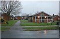
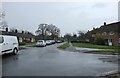
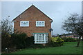
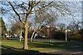
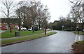
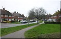
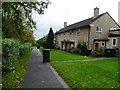
30 photos from this area
Area Information
Key information about the AL7 4RA including its size, population, and administrative classification.
- Area Type
- Postcode
- Area Size
- 2.3 hectares
- Population
- 1693
- Population Density
- 1849 people/km²
House Prices in AL7 4RA
38
Properties
£308,964
Average Sold Price
£68,500
Lowest Price
£545,000
Highest Price
Showing 38 properties
| Address | Type | Beds | Baths | Last Sale Price | Last Sale Date | |
|---|---|---|---|---|---|---|
| 87 Howlands, Welwyn Garden City, AL7 4RA | house | 3 | 1 | £450,000 | Jun 2025 | |
| 37 Howlands, Welwyn Garden City, AL7 4RA | Terraced | 3 | 1 | £445,000 | Mar 2025 | |
| 25 Howlands, Welwyn Garden City, AL7 4RA | Terraced | 3 | 1 | £395,000 | Dec 2023 | |
| 89 Howlands, Welwyn Garden City, AL7 4RA | Terraced | 3 | 1 | £395,000 | Oct 2023 | |
| 31 Howlands, Welwyn Garden City, AL7 4RA | house | - | - | £486,950 | Jun 2022 | |
| 81 Howlands, Welwyn Garden City, AL7 4RA | Retail | 3 | 1 | £545,000 | Apr 2022 | |
| 95 Howlands, Welwyn Garden City, AL7 4RA | house | - | - | £325,000 | Jan 2020 | |
| 35 Howlands, Welwyn Garden City, AL7 4RA | house | - | - | £342,000 | Mar 2018 | |
| 49 Howlands, Welwyn Garden City, AL7 4RA | Terraced | 3 | 1 | £375,000 | Oct 2015 | |
| 61 Howlands, Welwyn Garden City, AL7 4RA | Terraced | 3 | - | £299,000 | Aug 2015 |
Page 1 of 4
Energy Efficiency in AL7 4RA
Amenities
Schools
| Rank | School | Type | Entry gender | Ages |
|---|
Explore more schools in this area
Go to Schools tabDemographics
Household Size
Family (3-5 people)
most common
Accommodation Type
Houses
most common
Tenure
55
majority
Ethnic Group
White
most common
Religion
N/A
most common
Household Composition
N/A
most common
Age
47
median
Adults (30-64 years)
most common
Household Deprivation
N/A
with no deprivation
NS-SEC
33
in Lower managerial occupations
Explore more demographic insights in this area
Go to Demographics tabPlanning
Planning Constraints
- Flood RiskPremium
- Ramsar Wetland SitesPremium
- Area of Outstanding Natural BeautyPremium
- Protected Nature ReservePremium
- Protected WoodlandPremium