Area Overview for AL7 2QH
Photos of AL7 2QH
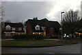
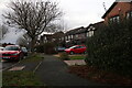
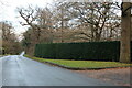
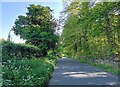
14 photos from this area
Area Information
Key information about the AL7 2QH including its size, population, and administrative classification.
- Area Type
- Postcode
- Area Size
- 4.5 hectares
- Population
- 1592
- Population Density
- 1789 people/km²
House Prices in AL7 2QH
14
Properties
£342,350
Average Sold Price
£122,500
Lowest Price
£755,000
Highest Price
Showing 14 properties
| Address | Type | Beds | Baths | Last Sale Price | Last Sale Date | |
|---|---|---|---|---|---|---|
| 32 Halifax Way, Welwyn Garden City, AL7 2QH | Terraced | 2 | 1 | £237,000 | Mar 2019 | |
| 1 Halifax Way, Welwyn Garden City, AL7 2QH | Detached | - | - | £360,000 | Feb 2018 | |
| 17 Halifax Way, Welwyn Garden City, AL7 2QH | Detached | 4 | - | £750,000 | Dec 2017 | |
| 21 Halifax Way, Welwyn Garden City, AL7 2QH | Detached | 5 | 3 | £755,000 | Jul 2017 | |
| 9 Halifax Way, Welwyn Garden City, AL7 2QH | house | - | - | £395,000 | Jun 2011 | |
| 26 Halifax Way, Welwyn Garden City, AL7 2QH | house | - | - | £164,000 | Aug 2010 | |
| 7 Halifax Way, Welwyn Garden City, AL7 2QH | Detached | - | - | £350,000 | Jun 2004 | |
| 28 Halifax Way, Welwyn Garden City, AL7 2QH | Terraced | - | - | £137,995 | Feb 2003 | |
| 30 Halifax Way, Welwyn Garden City, AL7 2QH | house | - | - | £122,500 | Aug 2002 | |
| 5 Halifax Way, Welwyn Garden City, AL7 2QH | Detached | - | - | £152,000 | Feb 1997 |
Page 1 of 2
Energy Efficiency in AL7 2QH
Amenities
Schools
| Rank | School | Type | Entry gender | Ages |
|---|
Explore more schools in this area
Go to Schools tabDemographics
Household Size
Two person
most common
Accommodation Type
Houses
most common
Tenure
75
majority
Ethnic Group
White
most common
Religion
N/A
most common
Household Composition
N/A
most common
Age
47
median
Adults (30-64 years)
most common
Household Deprivation
N/A
with no deprivation
NS-SEC
46
in Lower managerial occupations
Explore more demographic insights in this area
Go to Demographics tabPlanning
Planning Constraints
- Flood RiskPremium
- Ramsar Wetland SitesPremium
- Area of Outstanding Natural BeautyPremium
- Protected Nature ReservePremium
- Protected WoodlandPremium