Area Overview for AL7 1GA
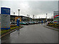
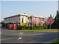
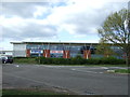
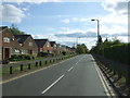
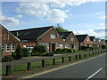
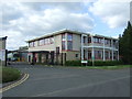
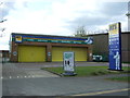
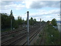
Photos of AL7 1GA


Area Information
Living in AL7 1GA means being part of a tightly knit residential cluster in Welwyn Garden City, a town known for its planned layout and suburban character. The area covers just 5.4 hectares, housing 1,579 people in a densely populated setting. This postcode falls within the Haldens electoral ward, a part of Welwyn Hatfield Borough Council, and is one of several small postcode areas that define the town’s suburban fabric. Daily life here is shaped by proximity to rail networks and local retail, with five nearby railway stations providing easy access to London and surrounding areas. The area’s compact size means amenities are within practical reach, though its small footprint also means it is a distinct micro-community within the larger town. Residents benefit from a mix of residential housing and nearby infrastructure, making it a practical choice for those seeking a balance between suburban living and commuter convenience. The population density, while high, reflects the area’s role as a focused residential node rather than a sprawling suburb.
- Area Type
- Postcode
- Area Size
- 5.4 hectares
- Population
- 1579
- Population Density
- 2578 people/km²
The property market in AL7 1GA is characterised by a 52% home ownership rate, with houses making up the predominant accommodation type. This suggests a largely owner-occupied area, though the remaining 48% may include rental properties or other tenure types. Given the small area size of 5.4 hectares and the high population density, the housing stock is likely to be compact, with limited scope for new development. The focus on houses rather than flats or apartments aligns with the suburban nature of Welwyn Garden City, where larger homes are common. For buyers, this means the market is likely to be stable, with properties catering to families and long-term residents. However, the small area’s limited size may restrict availability, making it a competitive market for those seeking homes in this specific postcode. Proximity to rail stations adds value, particularly for commuters, but the area’s size means buyers must consider the immediate surroundings for broader housing options.
House Prices in AL7 1GA
Showing 4 properties
| Address | Type | Beds | Baths | Last Sale Price | Last Sale Date | |
|---|---|---|---|---|---|---|
| Tesco Pear, Kestrel Way, Welwyn Garden City, AL7 1GA | Office | - | - | - | - | |
| Tesco Omega, Kestrel Way, Welwyn Garden City, AL7 1GA | Office | - | - | - | - | |
| Tesco Checkout, Kestrel Way, Welwyn Garden City, AL7 1GA | Office | - | - | - | - | |
| Tesco Checkout, Shire Park, Falcon Way, Welwyn Garden City, AL7 1GA | office_workshop | - | - | - | - |
Energy Efficiency in AL7 1GA
Residents of AL7 1GA have access to a range of nearby amenities that support daily life. The retail sector includes notable stores such as Tesco Shire, Co-op Knightsfield, and Aldi Bessemer, providing essential shopping options within walking or short driving distance. For transport, five railway stations—Welwyn Garden City, Welwyn North, Hatfield, and two others—are available, offering frequent services to London and surrounding areas. While the area lacks specific details on dining or leisure facilities, the presence of multiple retail outlets and rail connections suggests a functional, service-oriented lifestyle. The compact nature of the postcode means amenities are concentrated, reducing travel time for errands or commuting. However, the absence of named parks, cafes, or cultural venues in the data means the area’s leisure options are not explicitly detailed. Overall, the combination of retail and rail access supports a practical, suburban lifestyle, though residents may need to look slightly beyond the postcode for broader entertainment or recreational facilities.
Amenities
Schools
| Rank | School | Type | Entry gender | Ages |
|---|
Explore more schools in this area
Go to Schools tabDemographics
The community in AL7 1GA is predominantly composed of adults aged 30 to 64, with a median age of 47. This suggests a mature, stable population, likely with established careers and families. Home ownership rates stand at 52%, indicating a mix of owner-occupied properties and rental homes, though the exact proportion of rentals is not specified. The area’s accommodation is primarily houses, which is typical of suburban settings in England. The predominant ethnic group is White, reflecting broader demographic trends in Welwyn Garden City. While no specific data on deprivation or socioeconomic diversity is provided, the high home ownership rate and age profile suggest a relatively stable, middle-income community. The absence of detailed diversity metrics means the area’s cultural composition remains less defined in the data, but the presence of multiple retail outlets and rail connections hints at a functional, service-oriented local economy.
Household Size
Accommodation Type
Tenure
Ethnic Group
Religion
Household Composition
Age
Household Deprivation
NS-SEC
Explore more demographic insights in this area
Go to Demographics tabPlanning
Planning Constraints
- Flood RiskPremium
- Ramsar Wetland SitesPremium
- Area of Outstanding Natural BeautyPremium
- Protected Nature ReservePremium
- Protected WoodlandPremium