Area Overview for AL6 9EF
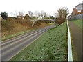
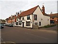
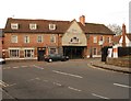
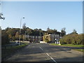
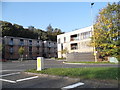
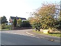
Photos of AL6 9EF


Area Information
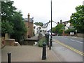
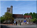
AL6 9EF is a small, tightly knit residential cluster in Hertfordshire, England, nestled within the historic village of Welwyn. With a population of 1,451 spread across 849 square metres, the area maintains a low density of 178 people per square kilometre, offering a quiet, community-focused atmosphere. Welwyn itself is a civil parish with roots dating back to the Roman era, when it served as a key posting station on the main east-west road connecting St Albans to Colchester. Today, it retains a distinct character separate from the nearby planned town of Welwyn Garden City, which emerged in 1920. Living here means being part of a settlement that balances historical heritage with modern convenience. The area’s proximity to the River Mimram and its position 25 miles north of London provide a blend of natural and urban accessibility. Residents benefit from nearby rail links and a range of local amenities, making AL6 9EF a practical choice for those seeking a stable, low-density environment with historical significance and practical connectivity.
- Area Type
- Postcode
- Area Size
- 849 m²
- Population
- 1451
- Population Density
- 178 people/km²
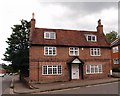
The property market in AL6 9EF is characterised by a high rate of home ownership—72% of properties are owner-occupied—suggesting a stable, long-term resident base. The accommodation type is predominantly houses, which is typical for rural and semi-rural areas in England. This implies a housing stock that prioritises family homes and single-dwelling units over flats or apartments, which may appeal to buyers seeking spacious, private living spaces. Given the area’s small size and low population density, the housing market is likely limited in scale but could offer a sense of community and exclusivity. However, the lack of rental properties—implied by the high ownership rate—may mean fewer options for those seeking short-term or flexible housing. Buyers should consider the area’s proximity to Welwyn Garden City and nearby transport links, which could influence property values and desirability for commuters.
House Prices in AL6 9EF
Showing 1 properties
| Address | Type | Beds | Baths | Last Sale Price | Last Sale Date | |
|---|---|---|---|---|---|---|
| Pharmacy At, 41 High Street, Welwyn, AL6 9EF | commercial | - | - | - | - |
Energy Efficiency in AL6 9EF
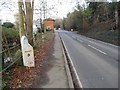
Living in AL6 9EF offers access to a range of practical amenities within easy reach. The retail landscape includes notable stores such as Tesco Welwyn, M&S Nodeway BP, and Co-op Knightsfield, providing everyday shopping convenience. The area’s rail links—Welwyn North, Welwyn Garden City, and Knebworth stations—offer seamless connections to London and surrounding towns, supporting both daily commutes and weekend travel. While the data does not specify parks or leisure facilities, the historical context of Welwyn suggests potential for green spaces, given its Roman origins and proximity to the River Mimram. The presence of local shops and transport options contributes to a self-contained lifestyle, reducing the need for long journeys. The character of the area, shaped by its historic roots and modern infrastructure, blends practicality with a sense of place, making it suitable for those who value accessibility without sacrificing a connection to local heritage.
Amenities
Schools
| Rank | School | Type | Entry gender | Ages |
|---|
Explore more schools in this area
Go to Schools tabDemographics
The community in AL6 9EF is predominantly composed of adults aged 30 to 64, with a median age of 47. This suggests a mature, established population, likely with long-term ties to the area. Home ownership is high, with 72% of properties occupied by their owners, indicating a stable housing market and a community focused on long-term residency. The accommodation type is primarily houses, reflecting a preference for single-family homes over flats or apartments. The predominant ethnic group is White, which aligns with broader demographic trends in rural Hertfordshire. While no specific data on deprivation is provided, the high home ownership rate and low population density suggest a relatively affluent, low-pressure living environment. The absence of detailed diversity metrics means the community’s full demographic profile remains partially unexplored, but the existing data points to a cohesive, settled population.
Household Size
Accommodation Type
Tenure
Ethnic Group
Religion
Household Composition
Age
Household Deprivation
NS-SEC
Explore more demographic insights in this area
Go to Demographics tabPlanning
Planning Constraints
- Flood RiskPremium
- Ramsar Wetland SitesPremium
- Area of Outstanding Natural BeautyPremium
- Protected Nature ReservePremium
- Protected WoodlandPremium