Area Overview for AL6 0WT
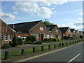
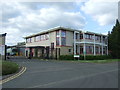
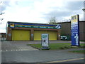
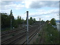
Photos of AL6 0WT


Area Information
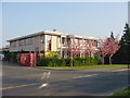
Living in AL6 0WT means inhabiting a small, tightly knit residential cluster in Hertfordshire, England. With a population of 1,275, this area is characterised by its compact footprint and proximity to key transport links. The community is primarily composed of adults aged 30–64, reflecting a mature demographic that likely values stability and established infrastructure. The area’s housing stock is dominated by flats, a feature that shapes both the local character and the dynamics of property ownership. While the postcode does not align with a Southampton Peartree Ward, it is distinct in its own right, with no significant environmental constraints such as flood zones, protected woodlands, or Ramsar sites. Residents benefit from strong digital connectivity, with broadband rated at 100/100, though mobile coverage is slightly lower at 85/100. Nearby, rail stations like Welwyn Garden City and Hatfield offer easy access to regional transport networks. AL6 0WT is a place where practicality meets accessibility, appealing to those seeking a balanced lifestyle with minimal environmental risk but a clear need for enhanced security measures.
- Area Type
- Postcode
- Area Size
- Not available
- Population
- 1275
- Population Density
- 1998 people/km²
The property market in AL6 0WT is defined by its high proportion of flats, which dominate the housing stock. With 59% of residents owning their homes, the area leans towards owner-occupation, though the presence of flats may also accommodate renters. This suggests a balance between long-term residents and those seeking more manageable housing options. The small size of the area means property availability is limited, potentially driving competition among buyers. Flats in this postcode are likely to be part of larger developments or purpose-built schemes, offering convenience for those prioritising proximity to amenities over space. For buyers, this implies a focus on location and accessibility rather than expansive living areas. The immediate surroundings may offer similar housing types, but the compact nature of AL6 0WT means buyers must consider nearby areas for more diverse options.
House Prices in AL6 0WT
No properties found in this postcode.
Energy Efficiency in AL6 0WT
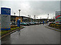
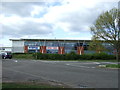
Residents of AL6 0WT have access to a range of retail and transport amenities within practical reach. Nearby shops include Aldi Bessemer, Tesco Shire, and Waitrose Welwyn, offering a mix of everyday essentials and premium grocery options. These stores cater to both convenience and quality, reflecting the area’s mature demographic. The rail network is particularly well-served, with stations such as Welwyn Garden City and Hatfield providing easy access to regional hubs. While the area lacks large parks or leisure facilities, the proximity to rail stations and retail hubs suggests a lifestyle focused on connectivity and practicality. The presence of multiple shops and transport links enhances daily life, allowing residents to manage errands and travel efficiently. However, the absence of named parks or cultural venues means outdoor and recreational opportunities may require a trip beyond the immediate postcode.
Amenities
Schools
| Rank | School | Type | Entry gender | Ages |
|---|
Explore more schools in this area
Go to Schools tabDemographics
The community in AL6 0WT is predominantly composed of adults aged 30–64, with a median age of 47. This suggests a mature, settled population, likely with established careers and family structures. Home ownership stands at 59%, indicating a mix of owner-occupied properties and rental units. The accommodation type is almost exclusively flats, reflecting a housing model suited to smaller households or those prioritising convenience over larger living spaces. The predominant ethnic group is White, though no specific data on diversity or deprivation is provided. The age profile and ownership figures suggest a community that values stability, with a focus on long-term residency. However, the lack of detailed diversity metrics means broader social dynamics remain unexplored. The absence of younger demographics or higher deprivation indicators implies a relatively affluent or middle-income area, though this remains speculative without further data.
Household Size
Accommodation Type
Tenure
Ethnic Group
Religion
Household Composition
Age
Household Deprivation
NS-SEC
Explore more demographic insights in this area
Go to Demographics tabPlanning
Planning Constraints
- Flood RiskPremium
- Ramsar Wetland SitesPremium
- Area of Outstanding Natural BeautyPremium
- Protected Nature ReservePremium
- Protected WoodlandPremium