Area Overview for AL6 0AS
Photos of AL6 0AS
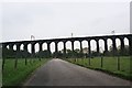

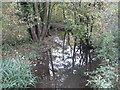

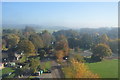
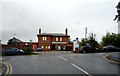

44 photos from this area
Area Information
Key information about the AL6 0AS including its size, population, and administrative classification.
- Area Type
- Postcode
- Area Size
- 3.9 hectares
- Population
- 1645
- Population Density
- 474 people/km²
House Prices in AL6 0AS
13
Properties
£799,813
Average Sold Price
£487,500
Lowest Price
£1,310,000
Highest Price
Showing 13 properties
| Address | Type | Beds | Baths | Last Sale Price | Last Sale Date | |
|---|---|---|---|---|---|---|
| 33 Harmer Green Lane, Digswell, Welwyn, AL6 0AS | Detached | 4 | 1 | £1,310,000 | Mar 2025 | |
| 21 Harmer Green Lane, Digswell, Welwyn, AL6 0AS | house | - | - | £775,000 | Mar 2019 | |
| 25 Harmer Green Lane, Digswell, Welwyn, AL6 0AS | Detached | 5 | 3 | £850,000 | Oct 2013 | |
| 23 Harmer Green Lane, Digswell, Welwyn, AL6 0AS | Detached | 5 | 3 | £840,000 | Aug 2013 | |
| 35 Harmer Green Lane, Digswell, Welwyn, AL6 0AS | house | - | - | £735,000 | Feb 2013 | |
| 27 Harmer Green Lane, Digswell, Welwyn, AL6 0AS | Detached | 5 | 4 | £776,000 | Oct 2011 | |
| 37 Harmer Green Lane, Digswell, Welwyn, AL6 0AS | house | - | - | £625,000 | Jun 2009 | |
| 31 Harmer Green Lane, Digswell, Welwyn, AL6 0AS | Detached | - | - | £487,500 | Dec 2001 | |
| 19 Harmer Green Lane, Digswell, Welwyn, AL6 0AS | Detached | 5 | 3 | - | - | |
| Former 15, Harmer Green Lane, Digswell, Welwyn, AL6 0AS | undefined | - | - | - | - |
Page 1 of 2
Energy Efficiency in AL6 0AS
Amenities
Schools
| Rank | School | Type | Entry gender | Ages |
|---|
Explore more schools in this area
Go to Schools tabDemographics
Household Size
Family (3-5 people)
most common
Accommodation Type
Houses
most common
Tenure
89
majority
Ethnic Group
White
most common
Religion
N/A
most common
Household Composition
N/A
most common
Age
47
median
Adults (30-64 years)
most common
Household Deprivation
N/A
with no deprivation
NS-SEC
58
in Lower managerial occupations
Explore more demographic insights in this area
Go to Demographics tabPlanning
Planning Constraints
- Flood RiskPremium
- Ramsar Wetland SitesPremium
- Area of Outstanding Natural BeautyPremium
- Protected Nature ReservePremium
- Protected WoodlandPremium