Area Overview for AL5 4UL
Photos of AL5 4UL
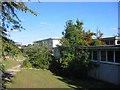
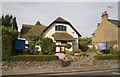
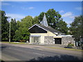
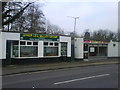
77 photos from this area
Area Information
Key information about the AL5 4UL including its size, population, and administrative classification.
- Area Type
- Postcode
- Area Size
- 5958 m²
- Population
- 1541
- Population Density
- 5149 people/km²
House Prices in AL5 4UL
14
Properties
£441,146
Average Sold Price
£215,000
Lowest Price
£725,000
Highest Price
Showing 14 properties
| Address | Type | Beds | Baths | Last Sale Price | Last Sale Date | |
|---|---|---|---|---|---|---|
| 208 Station Road, Harpenden, AL5 4UL | Semi-detached | 3 | 2 | £670,000 | Jul 2022 | |
| 202 Station Road, Harpenden, AL5 4UL | Semi-detached | 4 | 3 | £725,000 | Apr 2022 | |
| 192 Station Road, Harpenden, AL5 4UL | Terraced | 2 | 2 | £420,000 | Dec 2020 | |
| 184 Station Road, Harpenden, AL5 4UL | Cottage | 2 | 1 | £365,000 | Nov 2019 | |
| 194 Station Road, Harpenden, AL5 4UL | Semi-detached | 2 | 1 | £380,000 | Sep 2019 | |
| 190 Station Road, Harpenden, AL5 4UL | Terraced | 2 | 1 | £362,500 | Sep 2017 | |
| 200 Station Road, Harpenden, AL5 4UL | house | - | - | £725,000 | Aug 2017 | |
| 210 Station Road, Harpenden, AL5 4UL | house | - | - | £502,250 | Mar 2016 | |
| 188 Station Road, Harpenden, AL5 4UL | house | - | - | £329,000 | Sep 2014 | |
| 186 Station Road, Harpenden, AL5 4UL | Terraced | - | - | £275,000 | Mar 2010 |
Page 1 of 2
Energy Efficiency in AL5 4UL
Amenities
Schools
| Rank | School | Type | Entry gender | Ages |
|---|
Explore more schools in this area
Go to Schools tabDemographics
Household Size
Family (3-5 people)
most common
Accommodation Type
Houses
most common
Tenure
65
majority
Ethnic Group
White
most common
Religion
N/A
most common
Household Composition
N/A
most common
Age
47
median
Adults (30-64 years)
most common
Household Deprivation
N/A
with no deprivation
NS-SEC
52
in Lower managerial occupations
Explore more demographic insights in this area
Go to Demographics tabPlanning
Planning Constraints
- Flood RiskPremium
- Ramsar Wetland SitesPremium
- Area of Outstanding Natural BeautyPremium
- Protected Nature ReservePremium
- Protected WoodlandPremium