Area Overview for AL5 4RD
Photos of AL5 4RD
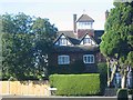
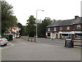
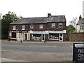
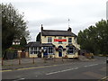
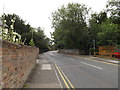
51 photos from this area
Area Information
Key information about the AL5 4RD including its size, population, and administrative classification.
- Area Type
- Postcode
- Area Size
- 2.6 hectares
- Population
- 1494
- Population Density
- 2889 people/km²
House Prices in AL5 4RD
46
Properties
£885,992
Average Sold Price
£122,500
Lowest Price
£1,825,000
Highest Price
Showing 46 properties
| Address | Type | Beds | Baths | Last Sale Price | Last Sale Date | |
|---|---|---|---|---|---|---|
| 32 West Way, Harpenden, AL5 4RD | Detached | 3 | 1 | £910,000 | Oct 2025 | |
| 44 West Way, Harpenden, AL5 4RD | Semi-detached | 4 | 2 | £1,060,000 | May 2025 | |
| 50 West Way, Harpenden, AL5 4RD | Detached | 3 | 2 | £749,250 | Mar 2025 | |
| 16 West Way, Harpenden, AL5 4RD | Detached | 5 | 3 | £1,620,000 | Dec 2024 | |
| 12 West Way, Harpenden, AL5 4RD | Detached | 5 | 4 | £1,673,500 | Feb 2024 | |
| 21 West Way, Harpenden, AL5 4RD | Detached | 6 | 3 | £1,825,000 | Aug 2023 | |
| 37 West Way, Harpenden, AL5 4RD | Semi-detached | 3 | 2 | £780,000 | Oct 2022 | |
| 6 West Way, Harpenden, AL5 4RD | Bungalow | 5 | 3 | £1,825,000 | May 2022 | |
| 4 West Way, Harpenden, AL5 4RD | Detached | 1 | 1 | £1,550,000 | Jan 2022 | |
| 9 West Way, Harpenden, AL5 4RD | Detached | 4 | 2 | £1,075,000 | Aug 2021 |
Page 1 of 5
Energy Efficiency in AL5 4RD
Amenities
Schools
| Rank | School | Type | Entry gender | Ages |
|---|
Explore more schools in this area
Go to Schools tabDemographics
Household Size
Family (3-5 people)
most common
Accommodation Type
Houses
most common
Tenure
78
majority
Ethnic Group
White
most common
Religion
N/A
most common
Household Composition
N/A
most common
Age
47
median
Adults (30-64 years)
most common
Household Deprivation
N/A
with no deprivation
NS-SEC
62
in Lower managerial occupations
Explore more demographic insights in this area
Go to Demographics tabPlanning
Planning Constraints
- Flood RiskPremium
- Ramsar Wetland SitesPremium
- Area of Outstanding Natural BeautyPremium
- Protected Nature ReservePremium
- Protected WoodlandPremium