Area Overview for AL5 4LL
Photos of AL5 4LL
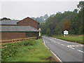
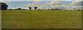
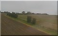
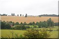
24 photos from this area
Area Information
Key information about the AL5 4LL including its size, population, and administrative classification.
- Area Type
- Postcode
- Area Size
- 10.8 hectares
- Population
- 1403
- Population Density
- 84 people/km²
House Prices in AL5 4LL
24
Properties
£435,747
Average Sold Price
£126,500
Lowest Price
£710,000
Highest Price
Showing 24 properties
| Address | Type | Beds | Baths | Last Sale Price | Last Sale Date | |
|---|---|---|---|---|---|---|
| 71 Springfield Crescent, Harpenden, AL5 4LL | Semi-detached | 3 | 1 | £685,000 | Dec 2024 | |
| 75 Springfield Crescent, Harpenden, AL5 4LL | Semi-detached | 3 | 1 | £710,000 | Apr 2024 | |
| 55 Springfield Crescent, Harpenden, AL5 4LL | house | - | - | £618,000 | Nov 2021 | |
| 65 Springfield Crescent, Harpenden, AL5 4LL | house | - | - | £675,000 | Jun 2021 | |
| 49 Springfield Crescent, Harpenden, AL5 4LL | Semi-detached | 3 | 1 | £560,000 | Dec 2018 | |
| 85 Springfield Crescent, Harpenden, AL5 4LL | house | - | - | £541,000 | Jul 2018 | |
| 77 Springfield Crescent, Harpenden, AL5 4LL | Semi-detached | 3 | 1 | £532,500 | Mar 2016 | |
| 67 Springfield Crescent, Harpenden, AL5 4LL | house | - | - | £455,500 | Sep 2014 | |
| 69 Springfield Crescent, Harpenden, AL5 4LL | house | - | - | £440,000 | May 2014 | |
| 41 Springfield Crescent, Harpenden, AL5 4LL | house | - | - | £435,000 | Jul 2013 |
Page 1 of 3
Energy Efficiency in AL5 4LL
Amenities
Schools
| Rank | School | Type | Entry gender | Ages |
|---|
Explore more schools in this area
Go to Schools tabDemographics
Household Size
Two person
most common
Accommodation Type
Houses
most common
Tenure
86
majority
Ethnic Group
White
most common
Religion
N/A
most common
Household Composition
N/A
most common
Age
47
median
Adults (30-64 years)
most common
Household Deprivation
N/A
with no deprivation
NS-SEC
56
in Lower managerial occupations
Explore more demographic insights in this area
Go to Demographics tabPlanning
Planning Constraints
- Flood RiskPremium
- Ramsar Wetland SitesPremium
- Area of Outstanding Natural BeautyPremium
- Protected Nature ReservePremium
- Protected WoodlandPremium