Area Overview for AL5 4BU
Photos of AL5 4BU
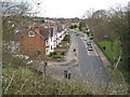
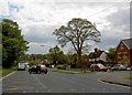
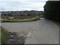


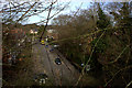
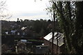
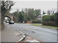
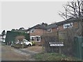
42 photos from this area
Area Information
Key information about the AL5 4BU including its size, population, and administrative classification.
- Area Type
- Postcode
- Area Size
- 7725 m²
- Population
- 1252
- Population Density
- 3219 people/km²
House Prices in AL5 4BU
14
Properties
£720,192
Average Sold Price
£195,000
Lowest Price
£1,301,000
Highest Price
Showing 14 properties
| Address | Type | Beds | Baths | Last Sale Price | Last Sale Date | |
|---|---|---|---|---|---|---|
| 61 Ambrose Lane, Harpenden, AL5 4BU | Semi-detached | 3 | 2 | £1,125,000 | Dec 2024 | |
| 49 Ambrose Lane, Harpenden, AL5 4BU | Semi-detached | 4 | 2 | £1,301,000 | Aug 2024 | |
| 41 Ambrose Lane, Harpenden, AL5 4BU | Semi-detached | 3 | 1 | £927,000 | Apr 2024 | |
| 35 Ambrose Lane, Harpenden, AL5 4BU | Detached | 4 | 2 | £850,000 | Nov 2023 | |
| 57 Ambrose Lane, Harpenden, AL5 4BU | Semi-detached | 3 | 1 | £1,100,000 | Oct 2022 | |
| 43 Ambrose Lane, Harpenden, AL5 4BU | house | - | - | £845,000 | Jun 2021 | |
| 55 Ambrose Lane, Harpenden, AL5 4BU | house | 3 | - | £557,500 | Aug 2011 | |
| 39 Ambrose Lane, Harpenden, AL5 4BU | house | 4 | - | £732,000 | Jun 2011 | |
| 51 Ambrose Lane, Harpenden, AL5 4BU | house | - | - | £560,000 | Dec 2009 | |
| 45 Ambrose Lane, Harpenden, AL5 4BU | Semi-detached | - | - | £461,000 | Oct 2006 |
Page 1 of 2
Energy Efficiency in AL5 4BU
Amenities
Schools
| Rank | School | Type | Entry gender | Ages |
|---|
Explore more schools in this area
Go to Schools tabDemographics
Household Size
Family (3-5 people)
most common
Accommodation Type
Houses
most common
Tenure
59
majority
Ethnic Group
White
most common
Religion
N/A
most common
Household Composition
N/A
most common
Age
47
median
Adults (30-64 years)
most common
Household Deprivation
N/A
with no deprivation
NS-SEC
50
in Lower managerial occupations
Explore more demographic insights in this area
Go to Demographics tabPlanning
Planning Constraints
- Flood RiskPremium
- Ramsar Wetland SitesPremium
- Area of Outstanding Natural BeautyPremium
- Protected Nature ReservePremium
- Protected WoodlandPremium