Area Overview for AL5 4AS
Photos of AL5 4AS
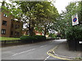
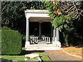
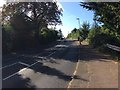


44 photos from this area
Area Information
Key information about the AL5 4AS including its size, population, and administrative classification.
- Area Type
- Postcode
- Area Size
- 5283 m²
- Population
- 1622
- Population Density
- 4081 people/km²
House Prices in AL5 4AS
9
Properties
£734,673
Average Sold Price
£196,500
Lowest Price
£1,144,000
Highest Price
Showing 9 properties
| Address | Type | Beds | Baths | Last Sale Price | Last Sale Date | |
|---|---|---|---|---|---|---|
| 31 Hollybush Lane, Harpenden, AL5 4AS | house | - | - | £1,144,000 | May 2021 | |
| 29 Hollybush Lane, Harpenden, AL5 4AS | Detached | 4 | 1 | £1,000,000 | Nov 2019 | |
| 23 Hollybush Lane, Harpenden, AL5 4AS | house | - | - | £860,037 | Jul 2015 | |
| 25 Hollybush Lane, Harpenden, AL5 4AS | house | - | - | £725,000 | May 2010 | |
| 17 Hollybush Lane, Harpenden, AL5 4AS | house | - | - | £482,500 | Aug 2003 | |
| 27 Hollybush Lane, Harpenden, AL5 4AS | house | - | - | £196,500 | Jun 1997 | |
| 19 Hollybush Lane, Harpenden, AL5 4AS | Detached | - | - | - | - | |
| 33 Hollybush Lane, Harpenden, AL5 4AS | Detached | - | - | - | - | |
| 21 Hollybush Lane, Harpenden, AL5 4AS | Detached | - | - | - | - |
Energy Efficiency in AL5 4AS
Amenities
Schools
| Rank | School | Type | Entry gender | Ages |
|---|
Explore more schools in this area
Go to Schools tabDemographics
Household Size
Family (3-5 people)
most common
Accommodation Type
Houses
most common
Tenure
86
majority
Ethnic Group
White
most common
Religion
N/A
most common
Household Composition
N/A
most common
Age
47
median
Adults (30-64 years)
most common
Household Deprivation
N/A
with no deprivation
NS-SEC
64
in Lower managerial occupations
Explore more demographic insights in this area
Go to Demographics tabPlanning
Planning Constraints
- Flood RiskPremium
- Ramsar Wetland SitesPremium
- Area of Outstanding Natural BeautyPremium
- Protected Nature ReservePremium
- Protected WoodlandPremium