Area Overview for AL5 2SF
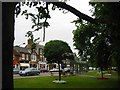
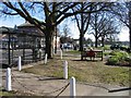
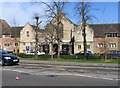
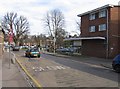
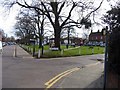
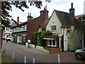
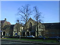
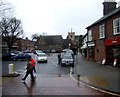
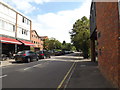
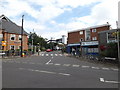
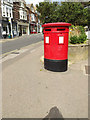
Photos of AL5 2SF

Area Information
AL5 2SF is a small residential postcode area in Harpenden, Hertfordshire, with a population of 1932 people spread across 1.26 km², giving it a high density of 1538 people per square kilometre. This compact cluster lies within a market town that has evolved from an agricultural village into a commuter hub for London. Harpenden’s character is defined by its historic roots, including a Roman road that once linked Cheshunt and Dunstable, and its modern role as a suburban settlement. The area retains a village feel, with a focus on residential living and proximity to natural spaces like Nomansland Common and Rothamsted Park. Daily life here is shaped by its mix of historic charm and practical amenities, from local shops to rail links. With schools, parks, and transport options within reach, AL5 2SF offers a balance of convenience and tranquillity, appealing to those seeking a settled, community-oriented lifestyle near London.
- Area Type
- Postcode
- Area Size
- Not available
- Population
- 1932
- Population Density
- 1538 people/km²
AL5 2SF is characterised by a 56% home ownership rate, with flats making up the majority of the housing stock. This suggests a mix of owner-occupied properties and rental units, though the exact proportion of rentals is not specified. The prevalence of flats indicates a compact, possibly older housing stock, typical of suburban or semi-rural areas. Given the area’s small size, property availability is limited, and buyers should consider proximity to nearby towns like St Albans or Luton for broader options. The flat-dominated market may appeal to those seeking lower-maintenance living, but it also means fewer detached homes or larger family properties. For buyers, the area’s proximity to transport links and amenities could offset the limited housing diversity.
House Prices in AL5 2SF
No properties found in this postcode.
Energy Efficiency in AL5 2SF
AL5 2SF offers a blend of practical amenities and natural spaces. Nearby, residents can access five retail outlets, including Cook Harpenden and Sainsburys Harpenden, ensuring everyday shopping needs are met. The area’s rail network connects to Harpenden, St Albans, and Luton, while London Luton Airport provides travel flexibility. For leisure, Nomansland Common and Rothamsted Park offer open spaces for walking, sports, and recreation. The town’s historic character, combined with modern conveniences, creates a lifestyle that balances suburban comfort with easy access to nature and urban facilities.
Amenities
Schools
AL5 2SF is served by a range of schools, including St Nicholas CofE VA Primary School (Ofsted rating: good) and St Dominic Catholic Primary School (Ofsted rating: outstanding), both offering primary education. Elmfield School specialises in special needs education, while Harpenden Free School and Harpenden Academy are academies with a good Ofsted rating. This mix provides families with options from early years through to secondary education. The presence of an outstanding primary school and a special needs school highlights the area’s commitment to inclusive education. Parents can choose between traditional state schools and academies, ensuring a variety of teaching approaches and resources. The proximity of these schools to residential areas makes AL5 2SF attractive for families prioritising education quality.
| Rank | School | Type | Entry gender | Ages |
|---|
Explore more schools in this area
Go to Schools tabDemographics
The population of AL5 2SF has a median age of 47, with the majority of residents aged between 30 and 64. This suggests a community skewed towards middle-aged adults, likely including professionals and families. Home ownership is at 56%, with flats being the predominant type of accommodation. The White ethnic group forms the largest demographic, though specific data on other groups is not provided. The age profile indicates a stable, established population, with fewer young families or retirees compared to other areas. This demographic mix may influence local services and amenities, with a focus on adult-oriented needs. The high home ownership rate suggests a degree of long-term residency, though the area’s small size means community dynamics are closely knit.
Household Size
Accommodation Type
Tenure
Ethnic Group
Religion
Household Composition
Age
Household Deprivation
NS-SEC
Explore more demographic insights in this area
Go to Demographics tabPlanning
Planning Constraints
- Flood RiskPremium
- Ramsar Wetland SitesPremium
- Area of Outstanding Natural BeautyPremium
- Protected Nature ReservePremium
- Protected WoodlandPremium