Area Overview for AL5 2EJ
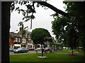
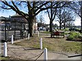
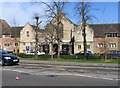
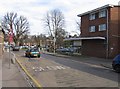
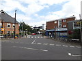
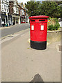
Photos of AL5 2EJ


Area Information
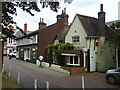
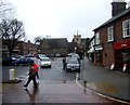
AL5 2EJ is a small, densely populated postcode area in Hertfordshire, covering just 660 m² and home to 1,932 residents. Despite its compact size, it reflects the character of Harpenden, a market town with roots in Roman history and a modern role as a commuter hub for London. The area retains a village feel, with a population skewed toward adults aged 30–64, many of whom live in flats. Its high population density of 1,538 people per km² suggests a tightly knit community, though the small footprint means proximity to amenities and green spaces is key. Residents benefit from nearby schools, rail links, and retail hubs, while the town’s historical ties to Rothamsted Experimental Station add a layer of scientific legacy. Living here means balancing suburban convenience with the charm of a historic settlement, where the Roman road once shaped daily life and now influences the rhythm of modern commuting.
- Area Type
- Postcode
- Area Size
- 660 m²
- Population
- 1932
- Population Density
- 1538 people/km²
AL5 2EJ’s property market is defined by its compact size and the prevalence of flats. With 56% of homes owner-occupied, the area leans toward a mix of long-term residents and renters, though the exact split between these groups is unclear. The dominance of flats suggests a housing stock shaped by post-war development and the town’s evolution from agricultural village to commuter settlement. Given the area’s small footprint, property availability is limited, and buyers may find competition for the few available units. The high population density further tightens the market, making it challenging for new entrants. For those considering purchase, the focus should be on flats in well-connected locations, as proximity to rail links and amenities like Harpenden’s retail hubs is critical. The market’s character is one of scarcity and stability, with limited scope for expansion.
House Prices in AL5 2EJ
No properties found in this postcode.
Energy Efficiency in AL5 2EJ
Daily life in AL5 2EJ is shaped by its proximity to retail, leisure, and green spaces. Within practical reach are five retail outlets, including Waitrose Harpenden and Morrisons Daily, offering a mix of local and national brands. Rail stations like Harpenden and St Albans City provide easy access to London and regional centers, while two airports cater to travel needs. The area’s historical roots are evident in sites like Rothamsted Experimental Station, which hosts long-term agricultural research and public amenities such as parks and sports facilities. Residents can enjoy countryside walks on Nomansland Common, where historical events like the Wars of the Roses and steeplechase racing once unfolded. The blend of modern convenience and heritage-rich surroundings creates a lifestyle that balances suburban ease with rural charm.
Amenities
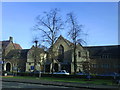
Schools
Residents of AL5 2EJ have access to a range of educational institutions, from primary schools to specialist provision. St Nicholas CofE VA Primary School and St Dominic Catholic Primary School both hold Ofsted ratings of ‘good’ and ‘outstanding’ respectively, offering strong early education options. Elmfield School provides special needs education, while Harpenden Free School and Harpenden Academy—both academies—cater to secondary education with ‘good’ and ‘outstanding’ ratings. This mix ensures families can find schools aligned with their values, whether seeking faith-based education or academically rigorous environments. The presence of both state and specialist institutions reflects Harpenden’s role as a commuter town with diverse educational needs. Parents can be confident in the quality of local provision, though the area’s small size means school catchment areas are tightly defined.
| Rank | School | Type | Entry gender | Ages |
|---|
Explore more schools in this area
Go to Schools tabDemographics
The median age in AL5 2EJ is 47, with the majority of residents falling within the 30–64 age range. This suggests a mature, stable community with a focus on established families and professionals. Home ownership stands at 56%, indicating a mix of owner-occupied properties and rental units, though the data does not specify the latter’s proportion. The predominant accommodation type is flats, likely reflecting the area’s compact nature and historical development patterns. The White ethnic group makes up the majority, though specific diversity metrics are not provided. With a population density of 1,538 people per km², the area is neither overcrowded nor isolated, offering a balance between urban and rural living. This density, combined with the age profile, implies a community with strong social networks and a reliance on local services for daily needs.
Household Size
Accommodation Type
Tenure
Ethnic Group
Religion
Household Composition
Age
Household Deprivation
NS-SEC
Explore more demographic insights in this area
Go to Demographics tabPlanning
Planning Constraints
- Flood RiskPremium
- Ramsar Wetland SitesPremium
- Area of Outstanding Natural BeautyPremium
- Protected Nature ReservePremium
- Protected WoodlandPremium