Area Overview for AL5 1PB
Photos of AL5 1PB

Area Information
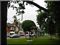
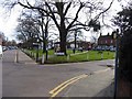
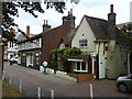
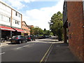
AL5 1PB represents a specific residential cluster within the market town of Harpenden, a settlement located on the dip slope of the Chiltern Hills in Hertfordshire. This postcode serves over 1,900 residents in a compact neighbourhood where population density reaches 1,538 people per square kilometre. The area functions as part of a larger community that evolved from an agricultural village into a significant commuter hub for London following the arrival of the Midland Railway in 1860. Historically known as "Herpe dene," a military path through the valley, the town retains its village character despite modern development pressures. The local centre is affectionately referred to as "the village" by those accustomed to the area's suburban feel. Living in AL5 1PB means residing in a location that balances historical depth with modern convenience. The settlement is situated astride three valleys running northwest to southeast, offering residents proximity to the countryside while maintaining access to urban services. This geographical setting has shaped the town's identity for centuries, from Anglo-Saxon boundaries to the industrial age transformations of the Victorian era. Homebuyers here occupy space within a defined community that draws on its past agrarian roots and scientific heritage, notably the Rothamsted Experimental Station established by John Bennet Lawes in 1843. The area stands as a testament to how infrastructure and commerce have reshaped rural landscapes into thriving residential zones without wholly erasing their original character.
- Area Type
- Postcode
- Area Size
- Not available
- Population
- 1932
- Population Density
- 1538 people/km²
The housing landscape in AL5 1PB is defined by a mix of accommodation types, with flats comprising the predominant form of residence. This structural preference shapes the local real estate market, offering a variety of options from studio units to larger family flats. A homeownership rate of 56% indicates that more than half of the dwellings are owner-occupied, contrasting with the higher rental proportions seen in London-centric squares. Buyers entering this sector purchase homes in an environment where stability and tenure are common values. The small residential cluster covers a limited footprint compared to wider boroughs, creating a tight-knit market where listings move promptly. Prospective purchasers looking at homes in AL5 1PB must consider the character of flat living within a high-density setting of 1,538 people per square kilometre. This configuration often delivers convenience but may limit garden space or privacy compared to detached suburban homes. The sheer volume of flats suggests development in earlier decades prioritised vertical living solutions over detached sprawl. Families considering relocation will find a stock that accommodates various household sizes, from singles to multi-generational groups. The market reflects the town's history of expansion during the Victorian era when land constraints drove inward growth. For those seeking entry points as a first home or downsizing opportunities, the prevalence of flats offers accessible pathways into the Harpenden property ladder. Understanding this stock mix is essential before committing to a purchase in this specific postcode.
House Prices in AL5 1PB
No properties found in this postcode.
Energy Efficiency in AL5 1PB
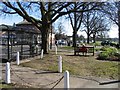
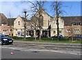
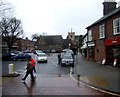
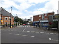
Residents of AL5 1PB enjoy immediate access to essential amenities within practical reach, supported by frequent rail links. Harpenden Railway Station, St Albans City Railway Station, and Luton Airport Parkway Railway Station provide five rail connections nearby, facilitating easy travel between the town and wider Hertfordshire or London. Retail offerings include Waitrose Harpenden, Morrisons Daily, and Sainsburys Harpenden, ensuring five major shopping locations are close by. Two airports serve the region, with London Luton Airport listed as a key facility for air travel. These five retail outlets stock groceries and daily necessities, reducing the need for frequent car trips to larger cities. The proximity to Nomansland Common adds a green leisure space, highlighting the town's blend of suburbia and countryside. Local sports facilities include a sports hall opened in 1975 and an indoor swimming pool established in 2000, providing non-commercial recreation options. Harpenden Golf Club has operated since 1894, with a second club formed in 1932. The mix of historic estates and modern infrastructure creates a lifestyle where residents can shop, commute, and relax without traveling far. Dining and socialising likely occur in the town centre, affectionately known as "the village," offering a pleasant atmosphere for weekend visits. The combination of green spaces, sports facilities, and retail hubs supports a balanced daily routine.
Amenities
Schools
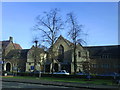
Families residing or considering living in AL5 1PB benefit from proximity to several educational institutions with verified performance ratings. St Nicholas CofE VA Primary School offers primary education under a rating of good according to Ofsted standards. St Dominic Catholic Primary School further serves the local community with an outstanding Ofsted rating, signifying high educational quality. Elmfield School operates as a special provision centre, catering to specific learning needs within the Harpenden area. Harpenden Free School functions as an academy providing alternative academic pathways for students. Harpenden Academy also holds an academy status with a good Ofsted rating, supporting secondary or further education requirements. This mix of schools provides comprehensive choices located near the residential cluster. The presence of both Church of England and Catholic primary options indicates diverse faith-based educational heritage tracing back to the parish church founded in 1217. Families can select institutions based on educational philosophy, exam performance, or accessibility. The inclusion of academy and special schools demonstrates a robust local education network designed to meet varied student requirements. Schools near AL5 1PB ensure that commute times remain short for parents working in the town or commuting London. Quality considerations are paramount when choosing schools, and these options offer evidence-based assurance of their standing through formal inspections.
| Rank | School | Type | Entry gender | Ages |
|---|
Explore more schools in this area
Go to Schools tabDemographics
The community profile in AL5 1PB reflects a mature population where the median age sits at 47 years. Adults spanning the 30 to 64 years age range constitute the most common demographic group within this postcode. Over half of the buildings contain flats, indicating a significant proportion of the housing stock accommodates multiple households or smaller family units. Home ownership stands at 56%, suggesting a substantial portion of residents possess their properties outright or through a mortgage. Ethnic diversity is heavily weighted towards the White population, which remains the predominant ethnic group in this specific sector. These figures paint a picture of a settled neighbourhood where long-term residents and stable families likely form the core of daily life. The ownership rate of 56% implies fewer frequent movers compared to areas with rental dominance, contributing to a sense of permanence. With a population of 1,932 densely packed into 1.538 people per square kilometre, interactions between neighbours occur frequently. The high concentration of adults between three decades and retirement age suggests children in the primary school stage are present, though the working-age population drives the economy. This demographic composition supports local businesses and services that cater to established households rather than transient workers. The absence of significant youth under 30 or elderly over 75 as major groups indicates a balanced but slightly older social fabric. Understanding these numbers helps buyers anticipate the type of community they will join upon purchasing homes in AL5 1PB.
Household Size
Accommodation Type
Tenure
Ethnic Group
Religion
Household Composition
Age
Household Deprivation
NS-SEC
Explore more demographic insights in this area
Go to Demographics tabPlanning
Planning Constraints
- Flood RiskPremium
- Ramsar Wetland SitesPremium
- Area of Outstanding Natural BeautyPremium
- Protected Nature ReservePremium
- Protected WoodlandPremium