Area Overview for AL5 1LH
Photos of AL5 1LH
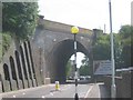
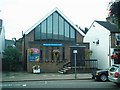
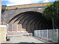
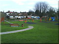
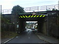
100 photos from this area
Area Information
Key information about the AL5 1LH including its size, population, and administrative classification.
- Area Type
- Postcode
- Area Size
- 7949 m²
- Population
- 1883
- Population Density
- 4649 people/km²
House Prices in AL5 1LH
15
Properties
£447,000
Average Sold Price
£80,000
Lowest Price
£850,000
Highest Price
Showing 15 properties
| Address | Type | Beds | Baths | Last Sale Price | Last Sale Date | |
|---|---|---|---|---|---|---|
| 6A Piggottshill Lane, Harpenden, AL5 1LH | Flat | - | - | £200,000 | Mar 2021 | |
| 18 Piggottshill Lane, Harpenden, AL5 1LH | Bungalow | 3 | 1 | £630,000 | Jan 2020 | |
| 20 Piggottshill Lane, Harpenden, AL5 1LH | Bungalow | 3 | 1 | £650,000 | Aug 2019 | |
| 26 Piggottshill Lane, Harpenden, AL5 1LH | house | - | - | £710,000 | Jul 2018 | |
| 14 Piggottshill Lane, Harpenden, AL5 1LH | Bungalow | - | - | £625,000 | Mar 2017 | |
| 22 Piggottshill Lane, Harpenden, AL5 1LH | house | - | - | £850,000 | Jan 2014 | |
| 28 Piggottshill Lane, Harpenden, AL5 1LH | house | - | - | £485,000 | Dec 2010 | |
| Ffordd-las, 16 Piggottshill Lane, Harpenden, AL5 1LH | Detached | 4 | 3 | £275,000 | Jul 2005 | |
| Former, 6A Piggottshill Lane, Harpenden, AL5 1LH | Flat | - | - | £80,000 | Jan 2004 | |
| 4B Piggottshill Lane, Harpenden, AL5 1LH | Flat | - | - | £235,000 | Sep 2002 |
Page 1 of 2
Energy Efficiency in AL5 1LH
Amenities
Schools
| Rank | School | Type | Entry gender | Ages |
|---|
Explore more schools in this area
Go to Schools tabDemographics
Household Size
Family (3-5 people)
most common
Accommodation Type
Houses
most common
Tenure
70
majority
Ethnic Group
White
most common
Religion
N/A
most common
Household Composition
N/A
most common
Age
47
median
Adults (30-64 years)
most common
Household Deprivation
N/A
with no deprivation
NS-SEC
53
in Lower managerial occupations
Explore more demographic insights in this area
Go to Demographics tabPlanning
Planning Constraints
- Flood RiskPremium
- Ramsar Wetland SitesPremium
- Area of Outstanding Natural BeautyPremium
- Protected Nature ReservePremium
- Protected WoodlandPremium