Area Overview for AL4 9XU
Photos of AL4 9XU

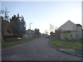
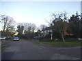
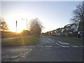
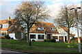
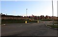
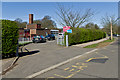
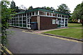
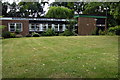
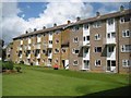
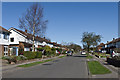
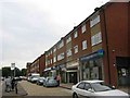
12 photos from this area
Area Information
Key information about the AL4 9XU including its size, population, and administrative classification.
- Area Type
- Postcode
- Area Size
- 3.0 hectares
- Population
- 2016
- Population Density
- 2457 people/km²
House Prices in AL4 9XU
35
Properties
£537,214
Average Sold Price
£194,950
Lowest Price
£1,180,000
Highest Price
Showing 35 properties
| Address | Type | Beds | Baths | Last Sale Price | Last Sale Date | |
|---|---|---|---|---|---|---|
| 24 Damson Way, St Albans, AL4 9XU | Detached | 4 | 2 | £970,000 | Sep 2024 | |
| 20 Damson Way, St Albans, AL4 9XU | Detached | 4 | 2 | £1,180,000 | Dec 2022 | |
| 29 Damson Way, St Albans, AL4 9XU | Detached | 5 | 3 | £1,090,000 | Oct 2021 | |
| 10 Damson Way, St Albans, AL4 9XU | Detached | 4 | - | £825,000 | May 2015 | |
| 30 Damson Way, St Albans, AL4 9XU | Detached | 4 | - | £790,000 | Oct 2013 | |
| 21 Damson Way, St Albans, AL4 9XU | house | - | - | £827,500 | Nov 2012 | |
| 12 Damson Way, St Albans, AL4 9XU | house | 5 | - | £810,000 | Jul 2010 | |
| 23 Damson Way, St Albans, AL4 9XU | Detached | 4 | - | £615,000 | Jul 2010 | |
| 19 Damson Way, St Albans, AL4 9XU | house | 4 | - | £700,000 | May 2010 | |
| 15 Damson Way, St Albans, AL4 9XU | Detached | - | - | £675,000 | Apr 2008 |
Page 1 of 4
Energy Efficiency in AL4 9XU
Amenities
Schools
| Rank | School | Type | Entry gender | Ages |
|---|
Explore more schools in this area
Go to Schools tabDemographics
Household Size
Family (3-5 people)
most common
Accommodation Type
Houses
most common
Tenure
63
majority
Ethnic Group
White
most common
Religion
N/A
most common
Household Composition
N/A
most common
Age
47
median
Adults (30-64 years)
most common
Household Deprivation
N/A
with no deprivation
NS-SEC
48
in Lower managerial occupations
Explore more demographic insights in this area
Go to Demographics tabPlanning
Planning Constraints
- Flood RiskPremium
- Ramsar Wetland SitesPremium
- Area of Outstanding Natural BeautyPremium
- Protected Nature ReservePremium
- Protected WoodlandPremium