Area Overview for AL4 9UF
Photos of AL4 9UF
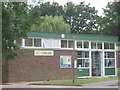
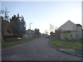
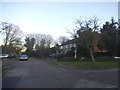
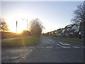
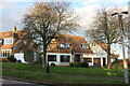
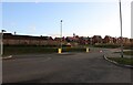
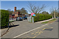
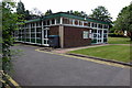
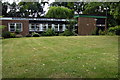
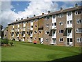
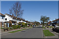
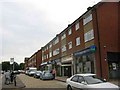
12 photos from this area
Area Information
Key information about the AL4 9UF including its size, population, and administrative classification.
- Area Type
- Postcode
- Area Size
- 1.0 hectares
- Population
- 2016
- Population Density
- 2457 people/km²
House Prices in AL4 9UF
22
Properties
£449,644
Average Sold Price
£149,000
Lowest Price
£925,000
Highest Price
Showing 22 properties
| Address | Type | Beds | Baths | Last Sale Price | Last Sale Date | |
|---|---|---|---|---|---|---|
| 17 Barnfield Road, St Albans, AL4 9UF | Semi-detached | 4 | 2 | £925,000 | Dec 2024 | |
| 3 Barnfield Road, St Albans, AL4 9UF | house | - | - | £775,000 | Jun 2021 | |
| 37 Barnfield Road, St Albans, AL4 9UF | Semi-detached | 4 | 2 | £470,000 | Sep 2020 | |
| 43 Barnfield Road, St Albans, AL4 9UF | Semi-detached | 2 | 1 | £440,000 | Sep 2019 | |
| 21 Barnfield Road, St Albans, AL4 9UF | Semi-detached | 3 | 1 | £575,000 | Jan 2019 | |
| 41 Barnfield Road, St Albans, AL4 9UF | Semi-detached | 2 | 1 | £465,000 | Dec 2017 | |
| 27 Barnfield Road, St Albans, AL4 9UF | Semi-detached | 2 | 1 | £450,000 | Oct 2017 | |
| 35 Barnfield Road, St Albans, AL4 9UF | Semi-detached | 2 | 2 | £668,000 | Aug 2017 | |
| 19 Barnfield Road, St Albans, AL4 9UF | Semi-detached | 3 | - | £470,000 | Dec 2014 | |
| 39 Barnfield Road, St Albans, AL4 9UF | Semi-detached | 2 | 1 | £345,000 | Feb 2014 |
Page 1 of 3
Energy Efficiency in AL4 9UF
Amenities
Schools
| Rank | School | Type | Entry gender | Ages |
|---|
Explore more schools in this area
Go to Schools tabDemographics
Household Size
Family (3-5 people)
most common
Accommodation Type
Houses
most common
Tenure
63
majority
Ethnic Group
White
most common
Religion
N/A
most common
Household Composition
N/A
most common
Age
47
median
Adults (30-64 years)
most common
Household Deprivation
N/A
with no deprivation
NS-SEC
48
in Lower managerial occupations
Explore more demographic insights in this area
Go to Demographics tabPlanning
Planning Constraints
- Flood RiskPremium
- Ramsar Wetland SitesPremium
- Area of Outstanding Natural BeautyPremium
- Protected Nature ReservePremium
- Protected WoodlandPremium