Area Overview for AL4 9TH
Photos of AL4 9TH
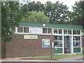
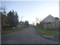
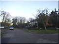
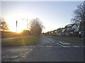
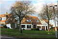
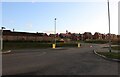
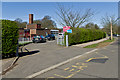
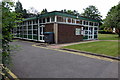
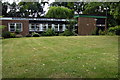
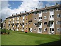
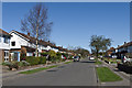
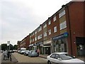
12 photos from this area
Area Information
Key information about the AL4 9TH including its size, population, and administrative classification.
- Area Type
- Postcode
- Area Size
- 8259 m²
- Population
- 1632
- Population Density
- 4132 people/km²
House Prices in AL4 9TH
13
Properties
£710,150
Average Sold Price
£294,000
Lowest Price
£1,210,000
Highest Price
Showing 13 properties
| Address | Type | Beds | Baths | Last Sale Price | Last Sale Date | |
|---|---|---|---|---|---|---|
| 13 Briar Road, St Albans, AL4 9TH | Semi-detached | 5 | 3 | £1,210,000 | Jul 2023 | |
| 25 Briar Road, St Albans, AL4 9TH | Semi-detached | 5 | 2 | £910,000 | Jun 2017 | |
| 17 Briar Road, St Albans, AL4 9TH | house | 5 | 3 | £865,000 | Oct 2015 | |
| 23 Briar Road, St Albans, AL4 9TH | Semi-detached | - | - | £860,000 | May 2015 | |
| 21 Briar Road, St Albans, AL4 9TH | Semi-detached | 3 | 1 | £540,000 | Oct 2013 | |
| 11 Briar Road, St Albans, AL4 9TH | house | 4 | - | £639,000 | Sep 2011 | |
| 5 Briar Road, St Albans, AL4 9TH | Semi-detached | 5 | 3 | £640,000 | Aug 2011 | |
| 1 Briar Road, St Albans, AL4 9TH | Land | 4 | 3 | £750,000 | Dec 2009 | |
| 3 Briar Road, St Albans, AL4 9TH | house | 4 | 3 | £393,500 | Sep 2005 | |
| 7 Briar Road, St Albans, AL4 9TH | Semi-detached | - | - | £294,000 | Sep 2001 |
Page 1 of 2
Energy Efficiency in AL4 9TH
Amenities
Schools
| Rank | School | Type | Entry gender | Ages |
|---|
Explore more schools in this area
Go to Schools tabDemographics
Household Size
Family (3-5 people)
most common
Accommodation Type
Houses
most common
Tenure
79
majority
Ethnic Group
White
most common
Religion
N/A
most common
Household Composition
N/A
most common
Age
47
median
Adults (30-64 years)
most common
Household Deprivation
N/A
with no deprivation
NS-SEC
46
in Lower managerial occupations
Explore more demographic insights in this area
Go to Demographics tabPlanning
Planning Constraints
- Flood RiskPremium
- Ramsar Wetland SitesPremium
- Area of Outstanding Natural BeautyPremium
- Protected Nature ReservePremium
- Protected WoodlandPremium