Area Overview for AL4 9QQ
Photos of AL4 9QQ
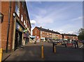
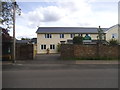
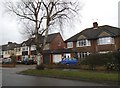
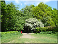
31 photos from this area
Area Information
Key information about the AL4 9QQ including its size, population, and administrative classification.
- Area Type
- Postcode
- Area Size
- 1.1 hectares
- Population
- 1599
- Population Density
- 3655 people/km²
House Prices in AL4 9QQ
17
Properties
£515,227
Average Sold Price
£114,950
Lowest Price
£875,000
Highest Price
Showing 17 properties
| Address | Type | Beds | Baths | Last Sale Price | Last Sale Date | |
|---|---|---|---|---|---|---|
| 53 Queens Crescent, St Albans, AL4 9QQ | house | - | - | £870,000 | Feb 2022 | |
| 18 Queens Crescent, St Albans, AL4 9QQ | house | - | - | £875,000 | Oct 2021 | |
| 28 Queens Crescent, St Albans, AL4 9QQ | Semi-detached | 3 | 1 | £560,000 | Mar 2014 | |
| 37 Queens Crescent, St Albans, AL4 9QQ | house | 5 | - | £850,000 | Oct 2013 | |
| 33 Queens Crescent, St Albans, AL4 9QQ | house | - | - | £540,000 | Nov 2011 | |
| 26 Queens Crescent, St Albans, AL4 9QQ | house | 4 | - | £517,500 | Jul 2011 | |
| 22 Queens Crescent, St Albans, AL4 9QQ | Semi-detached | - | - | £455,000 | Sep 2010 | |
| 43 Queens Crescent, St Albans, AL4 9QQ | house | 4 | - | £559,000 | Jun 2010 | |
| 41 Queens Crescent, St Albans, AL4 9QQ | house | - | - | £595,000 | Dec 2007 | |
| 47 Queens Crescent, St Albans, AL4 9QQ | house | 4 | 2 | £499,995 | Mar 2007 |
Page 1 of 2
Energy Efficiency in AL4 9QQ
Amenities
Schools
| Rank | School | Type | Entry gender | Ages |
|---|
Explore more schools in this area
Go to Schools tabDemographics
Household Size
Family (3-5 people)
most common
Accommodation Type
Houses
most common
Tenure
96
majority
Ethnic Group
White
most common
Religion
N/A
most common
Household Composition
N/A
most common
Age
47
median
Adults (30-64 years)
most common
Household Deprivation
N/A
with no deprivation
NS-SEC
58
in Lower managerial occupations
Explore more demographic insights in this area
Go to Demographics tabPlanning
Planning Constraints
- Flood RiskPremium
- Ramsar Wetland SitesPremium
- Area of Outstanding Natural BeautyPremium
- Protected Nature ReservePremium
- Protected WoodlandPremium