Area Overview for AL4 0YD
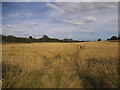
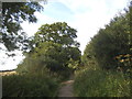
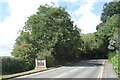
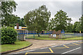
Photos of AL4 0YD


Area Information
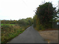
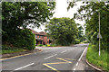
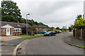
AL4 0YD is a small, tightly knit postcode area in Hertfordshire, located on the outskirts of St Albans. With a population of 1,932 and a density of 557 people per square kilometre, it is a compact residential cluster characterised by a mix of older and newer housing stock. The area’s history is deeply tied to Hill End Hospital, a former mental health asylum established in 1899 and operational until 1995. Today, the legacy of this institution shapes the local landscape, with remnants of its self-sufficient estate still visible. Despite its past, the area now offers a quiet, low-density living environment with easy access to nearby towns via the Alban Way, a former railway line. Residents benefit from proximity to St Albans City Railway Station and other nearby stations, ensuring connectivity to London and surrounding regions. The community here skews older, with a median age of 47, and is predominantly composed of homeowners. Daily life is defined by a balance of historical context and modern practicality, with amenities and transport links supporting both local needs and broader mobility.
- Area Type
- Postcode
- Area Size
- Not available
- Population
- 1932
- Population Density
- 557 people/km²
AL4 0YD is primarily an owner-occupied area, with 82% of properties in private hands. The accommodation type is predominantly houses, which is typical for a low-density, suburban postcode. Given the small population and limited land area, the housing stock is likely to be modest in scale, with limited scope for new developments. The high proportion of owner-occupied homes suggests a stable market, with properties potentially holding long-term value. For buyers, this means a focus on existing homes rather than rental opportunities, though the area’s proximity to St Albans and its transport links could make it attractive to commuters. The lack of flats or apartments may limit options for those seeking smaller or more affordable housing, but the existing stock caters to those prioritising space and privacy.
House Prices in AL4 0YD
No properties found in this postcode.
Energy Efficiency in AL4 0YD
Residents of AL4 0YD have access to a range of local amenities within practical reach. Retail options include Spar, Morrisons Fleetville, and other nearby shops, providing convenience for daily errands. The area’s proximity to multiple railway stations, such as St Albans City and St Albans Abbey, ensures easy access to public transport and broader regional connectivity. While specific parks or leisure facilities are not detailed in the data, the area’s historical context and low-density layout suggest potential for green spaces or recreational areas. The combination of retail, transport, and historical surroundings creates a lifestyle that balances practicality with a sense of place, though further details on leisure options would be needed for a fuller picture.
Amenities
Schools
The nearest school to AL4 0YD is Nicholas Breakspear Catholic School, which operates as both a primary school and an academy. It holds an outstanding Ofsted rating, reflecting high standards in education and student outcomes. The dual role of the school as a primary and academy suggests it serves a broad age range, potentially reducing the need for multiple educational institutions in the area. For families, this means a single, high-performing school is within practical reach, which can simplify childcare logistics. The outstanding rating indicates strong academic performance, facilities, and staff quality, making it a key draw for families considering the area. However, the absence of other schools in the data means the local education landscape is not fully detailed.
| Rank | School | Type | Entry gender | Ages |
|---|
Explore more schools in this area
Go to Schools tabDemographics
The population of AL4 0YD is 1,932, with a median age of 47, reflecting a community skewed towards adults aged 30–64. Home ownership is high, with 82% of residents living in owner-occupied homes, indicating a stable, long-term resident base. The area is predominantly composed of houses, rather than flats or apartments, which aligns with the low population density. The predominant ethnic group is White, though specific data on diversity or deprivation is not provided. The age profile suggests a mature demographic, potentially with fewer young families compared to other areas. This profile may influence local services and amenities, with a focus on accessibility for older residents. The high home ownership rate and older age group suggest a community with established roots, though the lack of detailed diversity data means broader social dynamics remain unexplored.
Household Size
Accommodation Type
Tenure
Ethnic Group
Religion
Household Composition
Age
Household Deprivation
NS-SEC
Explore more demographic insights in this area
Go to Demographics tabPlanning
Planning Constraints
- Flood RiskPremium
- Ramsar Wetland SitesPremium
- Area of Outstanding Natural BeautyPremium
- Protected Nature ReservePremium
- Protected WoodlandPremium