Area Overview for AL4 0SE
Photos of AL4 0SE
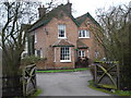
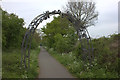
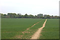
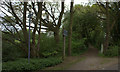
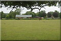
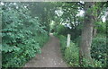
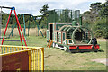
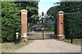
34 photos from this area
Area Information
Key information about the AL4 0SE including its size, population, and administrative classification.
- Area Type
- Postcode
- Area Size
- 44.2 hectares
- Population
- 1483
- Population Density
- 343 people/km²
House Prices in AL4 0SE
28
Properties
£477,413
Average Sold Price
£99,950
Lowest Price
£925,000
Highest Price
Showing 28 properties
| Address | Type | Beds | Baths | Last Sale Price | Last Sale Date | |
|---|---|---|---|---|---|---|
| 1, Ye Olde House, Sleapshyde, Smallford, St Albans, AL4 0SE | Semi-detached | 2 | 2 | £677,000 | Aug 2024 | |
| 3, Ye Olde House, Sleapshyde, Smallford, St Albans, AL4 0SE | Terraced | 2 | 1 | £417,000 | Jun 2023 | |
| Sunny Bank, Sleapshyde, Smallford, St Albans, AL4 0SE | Bungalow | - | - | £790,000 | Sep 2021 | |
| Ard Maca, Sleapshyde, Smallford, St Albans, AL4 0SE | Bungalow | 3 | 1 | £590,000 | Sep 2020 | |
| Penlu, Sleapshyde, Smallford, St Albans, AL4 0SE | Detached | 5 | 4 | £925,000 | Jun 2017 | |
| Serenity, Sleapshyde, Smallford, St Albans, AL4 0SE | Detached | - | - | £565,000 | Oct 2015 | |
| Chapel House, Sleapshyde, Smallford, St Albans, AL4 0SE | Bungalow | 2 | - | £460,000 | Jan 2014 | |
| Conifer Corner Bungalow, Sleapshyde, Smallford, St Albans, AL4 0SE | Detached | - | - | £385,000 | Nov 2008 | |
| Aylesford Cottage, Sleapshyde, Smallford, St Albans, AL4 0SE | Chalet | 3 | - | £520,000 | Aug 2005 | |
| 2, Ye Olde House, Sleapshyde, Smallford, St Albans, AL4 0SE | house | - | - | £175,000 | Jun 1999 |
Page 1 of 3
Energy Efficiency in AL4 0SE
Amenities
Schools
| Rank | School | Type | Entry gender | Ages |
|---|
Explore more schools in this area
Go to Schools tabDemographics
Household Size
Family (3-5 people)
most common
Accommodation Type
Houses
most common
Tenure
73
majority
Ethnic Group
White
most common
Religion
N/A
most common
Household Composition
N/A
most common
Age
47
median
Adults (30-64 years)
most common
Household Deprivation
N/A
with no deprivation
NS-SEC
40
in Lower managerial occupations
Explore more demographic insights in this area
Go to Demographics tabPlanning
Planning Constraints
- Flood RiskPremium
- Ramsar Wetland SitesPremium
- Area of Outstanding Natural BeautyPremium
- Protected Nature ReservePremium
- Protected WoodlandPremium