Area Overview for AL4 0LY
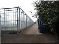
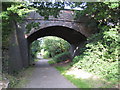
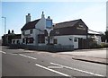
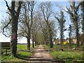
Photos of AL4 0LY


Area Information
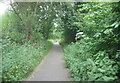
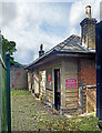
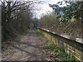
Living in AL4 0LY means inhabiting a small, tightly knit residential cluster on the outskirts of St Albans, Hertfordshire. With a population of 1,932 and a density of 557 people per square kilometre, the area feels more like a quiet village than a sprawling suburb. Its identity is deeply rooted in history: the former Hill End Hospital, a 20th-century mental health facility, once defined the landscape. Though the hospital closed in 1995, its legacy lingers in the area’s layout and proximity to Hill End railway station, now part of the Alban Way. Residents benefit from easy access to St Albans and nearby towns like Hatfield, with rail links to London and beyond. The area’s compact size fosters a sense of familiarity, while its modern amenities—such as retail outlets and strong digital connectivity—support contemporary living. AL4 0LY balances historical character with practicality, offering a peaceful yet connected lifestyle for those seeking a blend of tradition and convenience.
- Area Type
- Postcode
- Area Size
- Not available
- Population
- 1932
- Population Density
- 557 people/km²
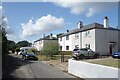
The property market in AL4 0LY is characterised by high home ownership (82%) and a predominance of houses. This suggests a stable, owner-occupied market rather than a rental-focused one, which is typical of smaller residential clusters. The concentration of houses implies a mix of semi-detached and detached properties, likely reflecting the area’s lower density and suburban character. Given the postcode’s small size, the housing stock is limited, meaning buyers may need to consider nearby areas for more options. The high ownership rate also indicates strong community ties, with residents likely prioritising long-term investment over short-term rental gains. For buyers, this means a focus on properties with established value, though the limited supply could drive competition. The absence of flats or apartments suggests a more traditional housing landscape, which may appeal to those seeking space and privacy.
House Prices in AL4 0LY
No properties found in this postcode.
Energy Efficiency in AL4 0LY
The lifestyle in AL4 0LY is shaped by its proximity to practical amenities, including five retail outlets such as Spar, Morrisons Fleetville, and other local shops. These provide everyday convenience for groceries, essentials, and light shopping. The area’s rail links to St Albans, Hatfield, and beyond offer easy access to larger towns for dining, entertainment, and cultural activities. While the postcode itself is small, the surrounding region likely includes parks and open spaces, though specific details are not provided. The legacy of Hill End Hospital’s infrastructure may influence the area’s character, but the current amenities focus on modern living. Residents benefit from a balance of local convenience and regional connectivity, making daily life both efficient and accessible.
Amenities
Schools
The most notable school near AL4 0LY is Nicholas Breakspear Catholic School, which operates as both a primary school and an academy with an outstanding Ofsted rating. This dual role means it serves students from early education through to secondary levels, offering a seamless academic pathway for families. The school’s high rating reflects strong educational standards, which is a significant draw for parents prioritising quality schooling. The presence of a single, high-performing institution suggests a focused approach to education in the area, though it may also mean limited choice for families seeking alternative schools. For those considering AL4 0LY, the school’s performance is a key factor, as it directly impacts long-term family planning and property value.
| Rank | School | Type | Entry gender | Ages |
|---|
Explore more schools in this area
Go to Schools tabDemographics
The community in AL4 0LY is predominantly middle-aged, with a median age of 47 and the majority of residents falling within the 30-64 age range. This suggests a stable population with established careers and families. Home ownership is high, at 82%, indicating a strong preference for long-term residency over renting. The accommodation type is largely houses, which aligns with the area’s lower density and suburban feel. The predominant ethnic group is White, though no specific data on diversity or deprivation is provided. The age profile and ownership figures point to a community that values security and continuity. With no mention of socioeconomic deprivation, the area likely offers a moderate quality of life, supported by its proximity to services and transport. The demographic profile suggests a focus on family-oriented living, reinforced by the presence of a top-rated school nearby.
Household Size
Accommodation Type
Tenure
Ethnic Group
Religion
Household Composition
Age
Household Deprivation
NS-SEC
Explore more demographic insights in this area
Go to Demographics tabPlanning
Planning Constraints
- Flood RiskPremium
- Ramsar Wetland SitesPremium
- Area of Outstanding Natural BeautyPremium
- Protected Nature ReservePremium
- Protected WoodlandPremium