Area Overview for AL4 0JT
Photos of AL4 0JT


Area Information
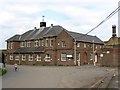
Living in AL4 0JT, a small residential postcode cluster on the outskirts of St Albans, means inhabiting a place shaped by its historical ties to Hill End Hospital. The area’s population of 1,932 people, spread across 557 residents per square kilometre, reflects a compact, tightly knit community. Historically, the site was dominated by the Hertfordshire County Asylum, established in 1899 and operational until 1995. Though the hospital is no longer active, its legacy remains in the landscape, with the former railway line now repurposed as the Alban Way. Today, AL4 0JT is a quiet, low-density area where houses predominate, and daily life is influenced by proximity to rail networks and local amenities. The area’s small size means residents share a shared sense of place, with easy access to nearby towns like Hatfield and St Albans. While the past is deeply embedded in the geography, the present offers modern connectivity, including excellent broadband and a network of rail stations within reach. For those seeking a balance between historical character and contemporary convenience, AL4 0JT provides a distinctive blend.
- Area Type
- Postcode
- Area Size
- Not available
- Population
- 1932
- Population Density
- 557 people/km²
The property market in AL4 0JT is characterised by a strong emphasis on owner-occupied homes, with 82% of properties owned by residents rather than rented. The accommodation type is predominantly houses, which is typical for smaller, low-density postcodes like this. This suggests a market skewed towards established, family homes rather than apartments or flats, which are less common in the area. The small size of AL4 0JT means the housing stock is likely to be limited, with properties concentrated in a compact cluster. For buyers, this implies a focus on quality over quantity, with homes likely to be well-maintained and situated in a low-traffic, residential environment. The proximity to St Albans and Hatfield may also influence property values, as the area benefits from easy access to larger towns without the congestion of urban centres. However, the limited number of properties means competition could be keen, particularly for homes with specific features or proximity to amenities.
House Prices in AL4 0JT
Showing 1 properties
| Address | Type | Beds | Baths | Last Sale Price | Last Sale Date | |
|---|---|---|---|---|---|---|
| Geesinknorba, Geesink Norba Ltd, Acrewood Way, St Albans, AL4 0JT | office_workshop | - | - | - | - |
Energy Efficiency in AL4 0JT
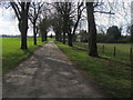
The lifestyle in AL4 0JT is shaped by its proximity to a range of practical amenities. Within reach are five retail outlets, including Spar and Morrisons Fleetville, ensuring everyday shopping needs are met without long journeys. The area’s rail network, with stations at St Albans City, Abbey, and Hatfield, provides easy access to larger towns and cities, supporting both leisure and commuting. While specific parks or leisure facilities are not detailed in the data, the historical presence of the Hill End Hospital estate may have left legacy green spaces or pathways. The Alban Way, a repurposed railway line, offers a route for walking or cycling, adding to the area’s appeal for active lifestyles. The combination of local shops, rail links, and historical infrastructure creates a convenient, low-stress environment where daily life is efficient and connected to broader regional opportunities.
Amenities
Schools
The nearest school to AL4 0JT is Nicholas Breakspear Catholic School, which serves both primary and academy functions. The school holds an outstanding Ofsted rating, reflecting high standards in education and student outcomes. As a dual-purpose institution, it provides a seamless transition for families from early years through to secondary education. The presence of an outstanding-rated school is a significant draw for families prioritising quality education, as it ensures access to a well-regarded curriculum and supportive learning environment. Given the area’s small size, the school is likely to be a central hub for local families, fostering a sense of community. The absence of other schools in the immediate vicinity means parents may need to consider travel time to additional educational options, but the high rating of Nicholas Breakspear Catholic School mitigates this concern.
| Rank | School | Type | Entry gender | Ages |
|---|
Explore more schools in this area
Go to Schools tabDemographics
The demographic profile of AL4 0JT is defined by its median age of 47, with the majority of residents falling within the 30–64 age range. This suggests a community of middle-aged and older adults, likely with established careers and long-term ties to the area. Home ownership is high at 82%, indicating a stable, owner-occupied demographic rather than a transient rental market. The accommodation type is predominantly houses, reflecting a preference for private, detached living. The predominant ethnic group is White, which aligns with broader trends in Hertfordshire. The absence of specific data on deprivation or diversity means the area’s social dynamics are not explicitly detailed, but the high home ownership and age profile imply a relatively affluent, settled population. For buyers, this suggests a community prioritising long-term residency and family-oriented living, with fewer pressures from short-term rental demand or demographic flux.
Household Size
Accommodation Type
Tenure
Ethnic Group
Religion
Household Composition
Age
Household Deprivation
NS-SEC
Explore more demographic insights in this area
Go to Demographics tabPlanning
Planning Constraints
- Flood RiskPremium
- Ramsar Wetland SitesPremium
- Area of Outstanding Natural BeautyPremium
- Protected Nature ReservePremium
- Protected WoodlandPremium