Area Overview for AL3 8RD
Photos of AL3 8RD
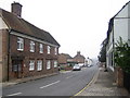
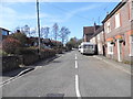
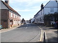
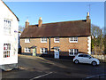
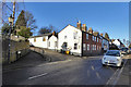
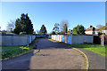
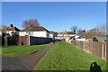
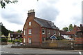
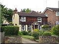
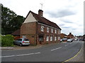
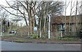
29 photos from this area
Area Information
Key information about the AL3 8RD including its size, population, and administrative classification.
- Area Type
- Postcode
- Area Size
- 1.7 hectares
- Population
- 1512
- Population Density
- 4341 people/km²
House Prices in AL3 8RD
29
Properties
£263,293
Average Sold Price
£60,000
Lowest Price
£500,000
Highest Price
Showing 29 properties
| Address | Type | Beds | Baths | Last Sale Price | Last Sale Date | |
|---|---|---|---|---|---|---|
| 36 Parkfield, Markyate, St Albans, AL3 8RD | Detached | 2 | 1 | £368,500 | Nov 2025 | |
| 14 Parkfield, Markyate, St Albans, AL3 8RD | Terraced | 4 | 1 | £500,000 | Mar 2025 | |
| 26 Parkfield, Markyate, St Albans, AL3 8RD | house | 2 | - | £330,000 | Jun 2021 | |
| 18 Parkfield, Markyate, St Albans, AL3 8RD | Terraced | 3 | 1 | £375,000 | Jun 2021 | |
| 8A Parkfield, Markyate, St Albans, AL3 8RD | house | - | - | £235,000 | Jan 2021 | |
| 56 Parkfield, Markyate, St Albans, AL3 8RD | house | - | - | £360,000 | Jan 2019 | |
| 48 Parkfield, Markyate, St Albans, AL3 8RD | house | - | - | £300,000 | Jan 2019 | |
| 40 Parkfield, Markyate, St Albans, AL3 8RD | Semi-detached | 2 | 1 | £269,950 | Apr 2016 | |
| 24 Parkfield, Markyate, St Albans, AL3 8RD | house | 3 | 1 | £263,900 | Nov 2014 | |
| 20 Parkfield, Markyate, St Albans, AL3 8RD | Terraced | 3 | 1 | £194,500 | Feb 2011 |
Page 1 of 3
Energy Efficiency in AL3 8RD
Amenities
Schools
| Rank | School | Type | Entry gender | Ages |
|---|
Explore more schools in this area
Go to Schools tabDemographics
Household Size
One person
most common
Accommodation Type
Houses
most common
Tenure
62
majority
Ethnic Group
White
most common
Religion
N/A
most common
Household Composition
N/A
most common
Age
47
median
Adults (30-64 years)
most common
Household Deprivation
N/A
with no deprivation
NS-SEC
39
in Lower managerial occupations
Explore more demographic insights in this area
Go to Demographics tabPlanning
Planning Constraints
- Flood RiskPremium
- Ramsar Wetland SitesPremium
- Area of Outstanding Natural BeautyPremium
- Protected Nature ReservePremium
- Protected WoodlandPremium