Area Overview for AL3 8PB
Photos of AL3 8PB
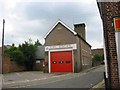
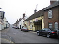

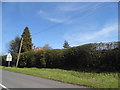

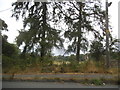
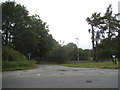
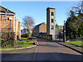
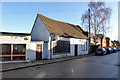
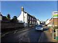

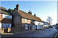
48 photos from this area
Area Information
Key information about the AL3 8PB including its size, population, and administrative classification.
- Area Type
- Postcode
- Area Size
- 5978 m²
- Population
- 1512
- Population Density
- 4341 people/km²
House Prices in AL3 8PB
20
Properties
£366,875
Average Sold Price
£200,000
Lowest Price
£650,000
Highest Price
Showing 20 properties
| Address | Type | Beds | Baths | Last Sale Price | Last Sale Date | |
|---|---|---|---|---|---|---|
| Cavendish Coach House, High Street, Markyate, St Albans, AL3 8PB | Mobile Home | 4 | 2 | £650,000 | Feb 2025 | |
| Cavendish Lodge, High Street, Markyate, St Albans, AL3 8PB | Semi-detached | 2 | 2 | £392,500 | Oct 2015 | |
| Lilly Fay House, High Street, Markyate, St Albans, AL3 8PB | house | 4 | 2 | £200,000 | Sep 2002 | |
| Cavendish House, High Street, Markyate, St Albans, AL3 8PB | Semi-detached | 6 | 2 | £225,000 | Aug 2001 | |
| Flat B, 38 High Street, Markyate, St Albans, AL3 8PB | Flat | 2 | 1 | - | - | |
| Flat A, 38 High Street, Markyate, St Albans, AL3 8PB | Flat | 2 | 1 | - | - | |
| 32D High Street, Markyate, St Albans, AL3 8PB | Terraced | 3 | 1 | - | - | |
| 32H High Street, Markyate, St Albans, AL3 8PB | Maisonette | 2 | 1 | - | - | |
| 1, Village Place, 34 High Street, Markyate, St Albans, AL3 8PB | Detached | 3 | - | - | - | |
| 32C High Street, Markyate, St Albans, AL3 8PB | house | 3 | - | - | - |
Page 1 of 2
Energy Efficiency in AL3 8PB
Amenities
Schools
| Rank | School | Type | Entry gender | Ages |
|---|
Explore more schools in this area
Go to Schools tabDemographics
Household Size
One person
most common
Accommodation Type
Houses
most common
Tenure
62
majority
Ethnic Group
White
most common
Religion
N/A
most common
Household Composition
N/A
most common
Age
47
median
Adults (30-64 years)
most common
Household Deprivation
N/A
with no deprivation
NS-SEC
39
in Lower managerial occupations
Explore more demographic insights in this area
Go to Demographics tabPlanning
Planning Constraints
- Flood RiskPremium
- Ramsar Wetland SitesPremium
- Area of Outstanding Natural BeautyPremium
- Protected Nature ReservePremium
- Protected WoodlandPremium