Area Overview for AL3 8DL
Photos of AL3 8DL

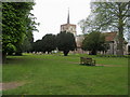
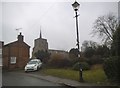
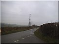
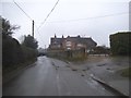
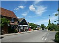
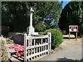
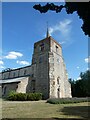
78 photos from this area
Area Information
Key information about the AL3 8DL including its size, population, and administrative classification.
- Area Type
- Postcode
- Area Size
- 4.0 hectares
- Population
- 1359
- Population Density
- 41 people/km²
House Prices in AL3 8DL
23
Properties
£360,292
Average Sold Price
£169,125
Lowest Price
£544,000
Highest Price
Showing 23 properties
| Address | Type | Beds | Baths | Last Sale Price | Last Sale Date | |
|---|---|---|---|---|---|---|
| 73 Trowley Hill Road, Flamstead, St Albans, AL3 8DL | house | - | - | £440,000 | Aug 2020 | |
| 99 Trowley Hill Road, Flamstead, St Albans, AL3 8DL | Terraced | 5 | - | £544,000 | Sep 2017 | |
| 95 Trowley Hill Road, Flamstead, St Albans, AL3 8DL | house | - | - | £435,000 | Apr 2017 | |
| 91 Trowley Hill Road, Flamstead, St Albans, AL3 8DL | house | - | - | £352,000 | Jun 2015 | |
| 57 Trowley Hill Road, Flamstead, St Albans, AL3 8DL | Detached | 4 | 2 | £540,000 | Oct 2007 | |
| 103 Trowley Hill Road, Flamstead, St Albans, AL3 8DL | Terraced | - | - | £285,000 | Oct 2005 | |
| 81 Trowley Hill Road, Flamstead, St Albans, AL3 8DL | house | - | - | £245,000 | Jan 2004 | |
| 83 Trowley Hill Road, Flamstead, St Albans, AL3 8DL | house | 3 | - | £232,500 | May 2003 | |
| 71 Trowley Hill Road, Flamstead, St Albans, AL3 8DL | Semi-detached | - | - | £169,125 | Feb 2002 | |
| 55 Trowley Hill Road, Flamstead, St Albans, AL3 8DL | Detached | 4 | 1 | - | - |
Page 1 of 3
Energy Efficiency in AL3 8DL
Amenities
Schools
| Rank | School | Type | Entry gender | Ages |
|---|
Explore more schools in this area
Go to Schools tabDemographics
Household Size
Two person
most common
Accommodation Type
Houses
most common
Tenure
68
majority
Ethnic Group
White
most common
Religion
N/A
most common
Household Composition
N/A
most common
Age
47
median
Adults (30-64 years)
most common
Household Deprivation
N/A
with no deprivation
NS-SEC
41
in Lower managerial occupations
Explore more demographic insights in this area
Go to Demographics tabPlanning
Planning Constraints
- Flood RiskPremium
- Ramsar Wetland SitesPremium
- Area of Outstanding Natural BeautyPremium
- Protected Nature ReservePremium
- Protected WoodlandPremium