Area Overview for AL3 6PG
Photos of AL3 6PG

Area Information
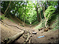
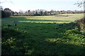
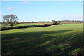
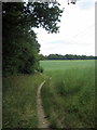
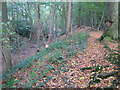
Bernards Heath is a residential neighbourhood situated northwest of the St Albans city centre within Hertfordshire. This specific postcode area covers a small cluster of homes across just 1.6 hectares, housing 2,059 residents. The location balances proximity to urban conveniences with significant distances to open countryside, defined historically by ancient common land. The area developed primarily during the late Victorian and Edwardian periods, creating an architecturally diverse landscape. Residents here enjoy access to the historic Bernards Heath green space, which dates back to Iron Age earthworks known as Beech Bottom Dyke. The neighbourhood retains a distinct character shaped by its history, including the Second Battle of St Albans fought on these heathlands in 1461. Modern living involves navigating a mix of original Victorian villas and later mid-20th century developments. The tight population density of 1,701 people per square kilometre suggests close-knit interactions between neighbours. Living in AL3 6PG appeals to those seeking a blend of historical weight and suburban tranquility without the isolation of rural living.
- Area Type
- Postcode
- Area Size
- 1609 m²
- Population
- 2059
- Population Density
- 1701 people/km²
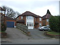
Homes in AL3 6PG are predominantly occupied by their own owners, with 67% of residents holding title to their properties. This statistic indicates that at least two-in-three households have achieved or inherited home ownership rather than renting. The accommodation type is almost exclusively houses, meaning you will find terraced, semi-detached, and detached structures rather than apartments or converted commercial units. This mix of house types offers variety in price points and garden sizes, catering to different family needs. The concentration of owner-occupied homes suggests a stable market where homes are often passed down through generations or bought as long-term investments. Buyers looking at this area can expect a stock of properties that have seen significant expenditure on maintenance over the decades. The architectural diversity mentioned in local histories, from Victorian villas to Edwardian semis, provides options for varied tastes. This section of St Albans does not function as a typical rental hub. Instead, it operates as a residential enclave where residents are committed to improving their assets and the surrounding streets through direct ownership.
House Prices in AL3 6PG
No properties found in this postcode.
Energy Efficiency in AL3 6PG
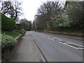
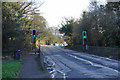
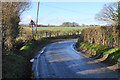
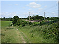
Daily life in AL3 6PG is supported by a proximity to key retail and transport hubs. Five retail options lie within practical reach, including Tesco St Albans, Morrisons Daily ST, and a branch on Cook Street. These supermarkets allow you to pick up groceries, household essentials, and fresh food without a lengthy journey to the city centre. For commuters, the area offers rail connections to St Albans City, St Albans Abbey, and Park Street stations. Five railway stations nearby provide frequent departures to major business hubs outside the immediate vicinity. The neighbourhood character is defined by its position near Bernards Heath, a green space that offers recreation and history. The ancient Beech Bottom Dyke runs nearby, providing a wooded path for walking or cycling. Residents can walk or cycle to their weekly shop at Tesco or Morrisons with minimal effort. The presence of these specific services ensures that basic needs are met comfortably within the local radius. You do not need to venture far for daily essentials. This balance of green space and urban amenities creates a convenient routine where work, school runs, and shopping coexist harmoniously.
Amenities
Schools
Families residing in AL3 6PG have access to St Albans Girls' School, which operates as both a primary institution and an academy. The academy status has earned the school an outstanding Ofsted rating, representing the highest standard of performance. This rating provides assurance regarding educational quality for children attending the facility from early years through to secondary education. Having a single school with dual status means parents have a consistent community hub for their children's education. The presence of an outstanding academy is a significant asset for residents selecting homes in this postcode area. It removes the uncertainty of varying standards often found across different local authorities. Parents can rely on a school that meets the rigorous criteria set by education inspectors. The proximity of this specific facility allows young residents to attend school without needing long commutes into the wider city. For those prioritising education, the combination of primary care and secondary education under one roof simplifies the school-run routine.
| Rank | School | Type | Entry gender | Ages |
|---|
Explore more schools in this area
Go to Schools tabDemographics
The community living in AL3 6PG skews towards middle adulthood, with a median age of 47 years. Adults between 30 and 64 years represent the most common age group, indicating a settlement favoured by established families rather than students or retirees. House ownership stands at an impressive 67%, reflecting stability and long-term residency among the local population. This high ownership rate typically correlates with children staying in the local school system and extended family networks taking root. The accommodation stock consists overwhelmingly of houses, creating streetscapes dominated by detached and semi-detached properties rather than flats. While the predominant ethnic group is White, the high ownership figures suggest a demographic increasingly composed of couples with children and older generations down-sized into the area. The area lacks the transient feel of student enclaves or high-density rental zones. This demographic profile points to a stable environment where residents invest heavily in their homes and local infrastructure. The population density ensures you are never truly alone, yet the area avoids the congestion of urban centres.
Household Size
Accommodation Type
Tenure
Ethnic Group
Religion
Household Composition
Age
Household Deprivation
NS-SEC
Explore more demographic insights in this area
Go to Demographics tabPlanning
Planning Constraints
- Flood RiskPremium
- Ramsar Wetland SitesPremium
- Area of Outstanding Natural BeautyPremium
- Protected Nature ReservePremium
- Protected WoodlandPremium