Area Overview for AL3 6GZ
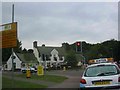
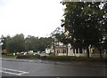
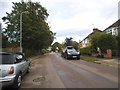
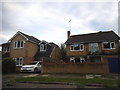
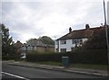
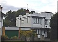
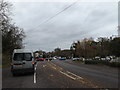
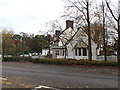
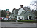
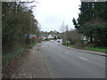
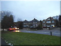
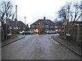
Photos of AL3 6GZ
Area Information
Living in AL3 6GZ means being part of a small, tightly knit residential cluster within the historic Batchwood Estate, on the outskirts of St Albans. With a population of just 1,916, the area feels intimate, offering a quiet contrast to the nearby city. The postcode covers a compact area centred around coordinates 51.759536, -0.33965, encompassing the legacy of Batchwood Hall, a listed manor house with ties to the Palace of Westminster’s Great Clock. Daily life here is shaped by proximity to St Albans’ rail network, with five nearby stations, including St Albans City Railway Station, providing easy access to the city and beyond. Retail options include Morrisons, M&S, and Tesco, ensuring practicality for everyday needs. The area’s character blends historical significance with modern convenience, making it appealing to those seeking a balance between heritage and accessibility.
- Area Type
- Postcode
- Area Size
- Not available
- Population
- 1916
- Population Density
- 3851 people/km²
The property market in AL3 6GZ is characterised by a high rate of home ownership (68%) and a focus on houses, which dominate the accommodation type. This suggests a community of established residents, many of whom are likely to have lived in the area for years. The prevalence of houses over flats or apartments indicates a market skewed towards family homes, with potential for larger properties compared to urban areas. However, the small size of the postcode area means the housing stock is limited, and buyers may need to consider nearby zones for more options. The high ownership rate also implies a lower rental market presence, though this does not preclude investment opportunities. For buyers, the area offers a blend of historical charm and practical living, though competition for properties may be keen due to its small scale.
House Prices in AL3 6GZ
No properties found in this postcode.
Energy Efficiency in AL3 6GZ
The lifestyle in AL3 6GZ is shaped by its proximity to St Albans’ amenities and the historic Batchwood Estate. Retail options include Morrisons, M&S, and Tesco, offering daily essentials within walking or short driving distance. The area’s rail connections provide easy access to the city’s cultural and commercial centres. The Batchwood Estate itself is a focal point, featuring an 18-hole golf course and leisure facilities, though some sports amenities were damaged by arson in 2011. The estate is currently undergoing redevelopment, with plans for a restaurant, bar, and hotel by 2025, adding future vibrancy. While the area lacks large parks or green spaces, the surrounding countryside and proximity to St Albans’ open areas offer recreational opportunities. This mix of historical sites, retail, and transport access creates a convenient yet characterful lifestyle.
Amenities
Schools
| Rank | School | Type | Entry gender | Ages |
|---|
Explore more schools in this area
Go to Schools tabDemographics
The community in AL3 6GZ is predominantly composed of adults aged 30–64, with a median age of 47. This suggests a mature, stable population, many of whom are likely long-term residents. Home ownership is high at 68%, indicating a strong sense of local investment and permanence. The area is primarily made up of houses, reflecting a residential profile focused on family homes rather than flats or apartments. The predominant ethnic group is White, with no specific data on other demographics. While this provides a clear picture of the population’s composition, it also highlights the need for further context on cultural diversity. The age profile and ownership rates suggest a community prioritising stability, with fewer transient residents.
Household Size
Accommodation Type
Tenure
Ethnic Group
Religion
Household Composition
Age
Household Deprivation
NS-SEC
Explore more demographic insights in this area
Go to Demographics tabPlanning
Planning Constraints
- Flood RiskPremium
- Ramsar Wetland SitesPremium
- Area of Outstanding Natural BeautyPremium
- Protected Nature ReservePremium
- Protected WoodlandPremium